Sites and Monuments Record · Ireland
Enclosure
Milltown St. John, County Tipperary South, Ireland
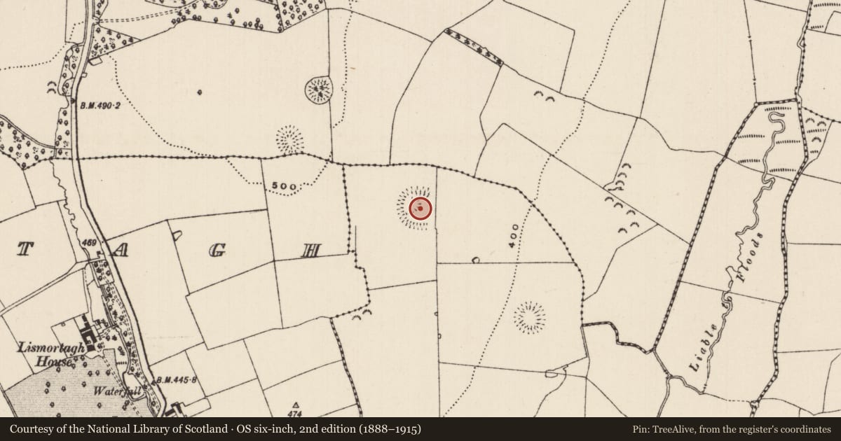
The record
- Townland
- Milltown St. John
- County
- Tipperary South
- Country
- Ireland
- First-edition OS map
- Not indicated
- Latest-edition OS map
- Hachured
- Coordinates
- 52.53440, -7.67100
- SMR number
- TS062-020----
Slide toward Today to fade the historical sheet and see the modern map underneath.
David Rumsey Map Collection, Stanford LibrariesDavid Rumsey Map Collection, Stanford LibrariesDavid Rumsey Map Collection, Stanford LibrariesDavid Rumsey Map Collection, Stanford Libraries
4 historical maps cover this location, the earliest the 1790 map "Composite: Ireland." (David Rumsey Map Collection, Stanford Libraries).
Historical maps covering this location
- 1790 · Composite: Ireland. (David Rumsey Map Collection, Stanford Libraries)
- 1882 · Ireland (southern half). (David Rumsey Map Collection, Stanford Libraries)
- 1891 · Ireland 16 (David Rumsey Map Collection, Stanford Libraries)
- 1904 · Sheet 13. (David Rumsey Map Collection, Stanford Libraries)
This record in the National Monuments Service's Historic Environment Viewer ↗
The National Monuments Service's description
In improved pasture, on an E-facing slope with good views over a small valley to E. Ringforts (TS062-019----, TS062-018---- and TS062-021----) lie c. 250m to WNW, 250m to NW and 260m to SE respectively. A semi-circular area (dims. 62.65m E-W; 55m N-S), open to the E (Wth 55m), defined by the remains of an earthen bank (overall Wth 8.1m; Wth at top 1.5m; int. H 0.35m; ext. H 0.65m) SSE-W-NNE; fosse (overall Wth 8.05m; basal Wth 1.25m; D 0.3m) SSE-W-NNE and well defined, low earthen outer bank (overall Wth 5.65m; Wth at top 1.65m; int. H 0.4m; ext. H 0.4m) S-W-NNE. A sub-oval quarried depression (dims. 34.3m E-W; 32m N-S; max. D 1.25m) occupies the centre and W sector of the interior and the fosse has been backfilled in the W quadrant due to quarrying activities. A field boundary runs N-S c. 5m to the E. The bank and fosse of the E quadrant are not visible at ground level on either side of this field boundary.
Compiled by: Jean Farrelly
Date of upload: 26 August 2011
Nearby in the register
- Ringfort - rathunder 1 mi
- Ringfort - rathunder 1 mi
- Ringfort - rathunder 1 mi
- Road - road/trackwayunder 1 mi
Other entries of the same register within about three miles of this one, by straight line.