Sites and Monuments Record · Ireland
Weir - fish
Ballygriffin (Ballygriffin Par.),Mantlehill Great, County Tipperary South, Ireland
The record
- Townland
- Ballygriffin (Ballygriffin Par.),Mantlehill Great
- County
- Tipperary South
- Country
- Ireland
- First-edition OS map
- Mill Weir
- Latest-edition OS map
- Not indicated
- Coordinates
- 52.51302, -7.98002
- SMR number
- TS060-077----
Slide toward Today to fade the historical sheet and see the modern map underneath.
David Rumsey Map Collection, Stanford LibrariesDavid Rumsey Map Collection, Stanford LibrariesDavid Rumsey Map Collection, Stanford LibrariesDavid Rumsey Map Collection, Stanford Libraries
4 historical maps cover this location, the earliest the 1790 map "Composite: Ireland." (David Rumsey Map Collection, Stanford Libraries).
Historical maps covering this location
- 1790 · Composite: Ireland. (David Rumsey Map Collection, Stanford Libraries)
- 1882 · Ireland (southern half). (David Rumsey Map Collection, Stanford Libraries)
- 1891 · Ireland 16 (David Rumsey Map Collection, Stanford Libraries)
- 1904 · Sheet 13. (David Rumsey Map Collection, Stanford Libraries)
This record in the National Monuments Service's Historic Environment Viewer ↗
The National Monuments Service's description
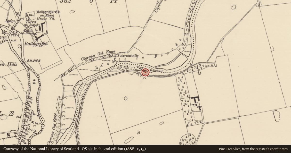
According to the Civil Survey (1654-6) the townland of Ballygriffin has two weirs for fishing (Simington 1934, vol. 2, 8). On the 1st (1840) ed. OS 6-inch map the E-W weir is depicted crossing the River Suir N and S of an island in the middle of the river and is called 'Mill Weir'. The two sections of the weir are indicated on the 2nd (1903-04) ed. as narrow islands which do not completely cross the river. The weir is not visible above the surface of the water, though it is likely that a large portion of the weir has been incorporated in the present island which consists of the smaller islands depicted on the 1st and 2nd ed. OS maps and intervening channels which have been infilled.
Compiled by: Jean Farrelly
Date of revised upload: 27 October 2015
References
Simington, R.C. (ed.) 1934 The Civil survey, AD 1654-1656. Vol. II: county of Tipperary - Western and Northern baronies. Dublin. Irish Manuscripts Commission.
Nearby in the register
- Enclosureunder 1 mi
- Linear earthworkunder 1 mi
- Moated siteunder 1 mi
- Enclosureunder 1 mi
Other entries of the same register within about three miles of this one, by straight line.