Sites and Monuments Record · Ireland
Enclosure
Donaskeagh, County Tipperary South, Ireland
The record
- Townland
- Donaskeagh
- County
- Tipperary South
- Country
- Ireland
- First-edition OS map
- Hachured
- Latest-edition OS map
- Hachured
- Coordinates
- 52.52507, -8.06295
- SMR number
- TS059-054----
Slide toward Today to fade the historical sheet and see the modern map underneath.
David Rumsey Map Collection, Stanford LibrariesDavid Rumsey Map Collection, Stanford LibrariesDavid Rumsey Map Collection, Stanford LibrariesDavid Rumsey Map Collection, Stanford Libraries
4 historical maps cover this location, the earliest the 1790 map "Composite: Ireland." (David Rumsey Map Collection, Stanford Libraries).
Historical maps covering this location
- 1790 · Composite: Ireland. (David Rumsey Map Collection, Stanford Libraries)
- 1882 · Ireland (southern half). (David Rumsey Map Collection, Stanford Libraries)
- 1891 · Ireland 16 (David Rumsey Map Collection, Stanford Libraries)
- 1904 · Sheet 13. (David Rumsey Map Collection, Stanford Libraries)
This record in the National Monuments Service's Historic Environment Viewer ↗
The National Monuments Service's description
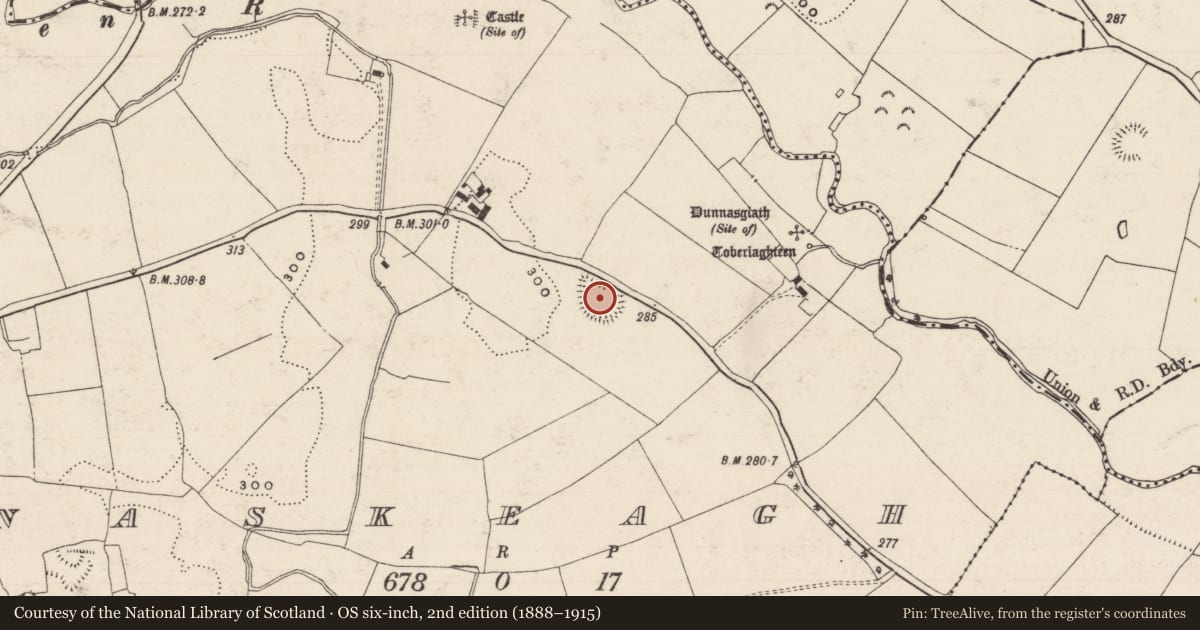
In improved pasture, on a low, natural rise of a SE-facing slope. Levelled remains of an oval area (dims. 43m NW-SE; 26m NE-SW) defined by traces of scarp which have been levelled off into the natural rise. It is visible as the curvilinear scarp (Wth 7.8m; H 0.8m) of a natural rise ESE-SSW and barely traceable possible scarp (Wth 2.75m; H 0.15m) from SSW-NNW. The irregular side to the NE also appears to fall with the natural slope. It is depicted on the 1840 and 1904 edition OS 6-inch map as a sub-oval enclosure truncated by a road across the NE sector. It is possibly the earthen fort mentioned by Flanagan (1930, 93) as 'Dún na Sciath', the location of which is depicted on the 1904 map c. 270m to the NE as 'Dunnasgiath (Site of)'.
Compiled by: Jean Farrelly
Date of upload: 26 August 2011
References
O'Flanagan, Rev. M. (Compiler) 1930 Letters containing information relative to the antiquities of the county of Tipperary collected during the progress of the Ordnance Survey in 1840. Bray.
Nearby in the register
- Churchunder 1 mi
- Ritual site - holy wellunder 1 mi
- Castle - unclassifiedunder 1 mi
- Enclosureunder 1 mi
Other entries of the same register within about three miles of this one, by straight line.