Sites and Monuments Record · Ireland
Ringfort - rath
Burnchurch, County Tipperary South, Ireland
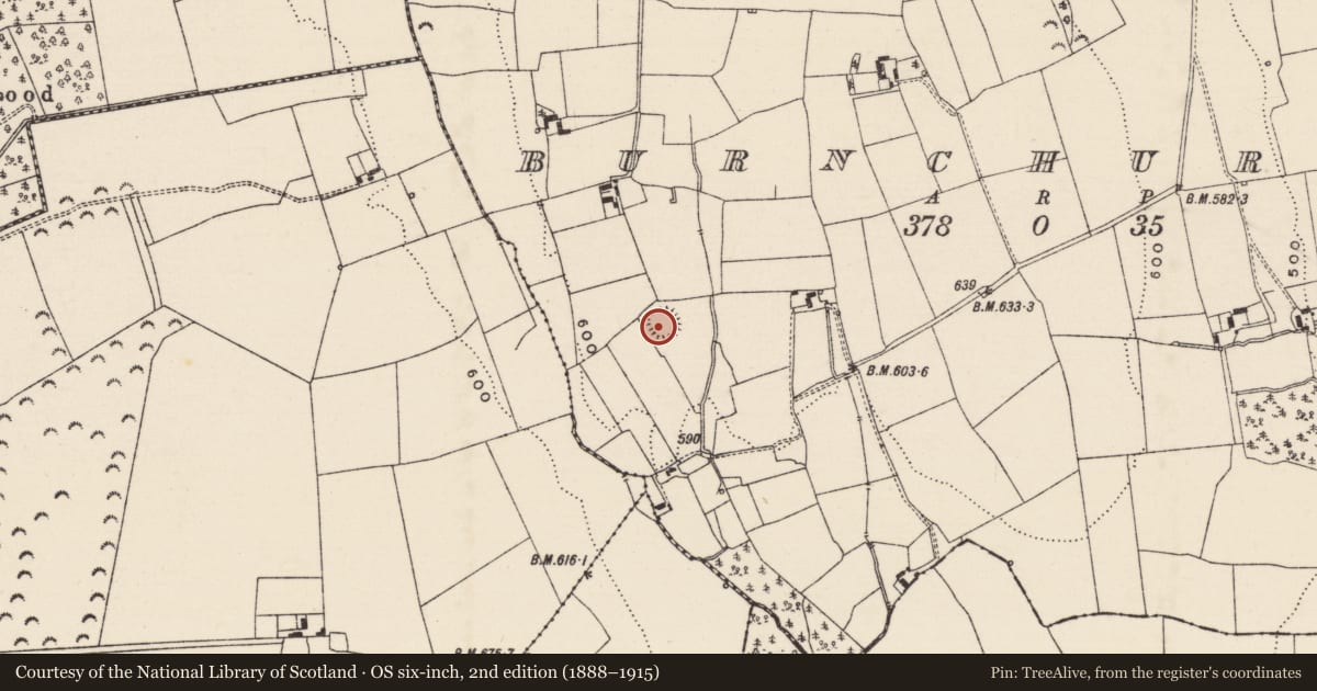
The record
- Townland
- Burnchurch
- County
- Tipperary South
- Country
- Ireland
- First-edition OS map
- Hachured
- Latest-edition OS map
- Hachured
- Coordinates
- 52.55791, -7.73739
- SMR number
- TS054-042----
Slide toward Today to fade the historical sheet and see the modern map underneath.
David Rumsey Map Collection, Stanford LibrariesDavid Rumsey Map Collection, Stanford LibrariesDavid Rumsey Map Collection, Stanford LibrariesDavid Rumsey Map Collection, Stanford Libraries
4 historical maps cover this location, the earliest the 1790 map "Composite: Ireland." (David Rumsey Map Collection, Stanford Libraries).
Historical maps covering this location
- 1790 · Composite: Ireland. (David Rumsey Map Collection, Stanford Libraries)
- 1882 · Ireland (southern half). (David Rumsey Map Collection, Stanford Libraries)
- 1891 · Ireland 16 (David Rumsey Map Collection, Stanford Libraries)
- 1904 · Sheet 13. (David Rumsey Map Collection, Stanford Libraries)
This record in the National Monuments Service's Historic Environment Viewer ↗
The National Monuments Service's description
In grassland on a S-facing slope of low hillock in undulating countryside with good views in all directions, ringfort in NW corner of field and heavily overgrown. Raised circular area (approx. int. diam. 28m N-S) enclosed by a tree lined earth and stone bank (ext. H 1.5-2.5m; int. H 0.5m; base Wth 3m; top Wth 1m) reduced to a scarp at S and slightest suggestion of a shallow external fosse too faint to measure. No entrance feature visible, ringfort covered in beech trees around the perimeter and thorn bushes in interior making detailed examination impossible. Livestock gaps in bank at SE (Wth 1.5m) at NNE (Wth 1.7m) and SW (Wth 2m), no clear entrance feature. Evidence of hazel coppices around perimeter, ringfort re-used as a landscape feature. Field boundary intersects external face of platform at N on an E-W axis and at W on a N-S axis as depicted on 1903 ed. OS 6-inch map. Perimeter appears to have been truncated, possibly by the landowner when he may have been tidying up the monument.
Compiled by: Jean Farrelly
Date of upload: 26 August 2011
Nearby in the register
- Ringfort - rathunder 1 mi
- Hilltop enclosureunder 1 mi
- Ringfort - rathunder 1 mi
- Castle - unclassifiedunder 1 mi
Other entries of the same register within about three miles of this one, by straight line.