Sites and Monuments Record · Ireland
Architectural fragment
Ardmayle, County Tipperary South, Ireland
The record
- Townland
- Ardmayle
- County
- Tipperary South
- Country
- Ireland
- First-edition OS map
- Not indicated
- Latest-edition OS map
- Not indicated
- Coordinates
- 52.56590, -7.92003
- SMR number
- TS052-034003-
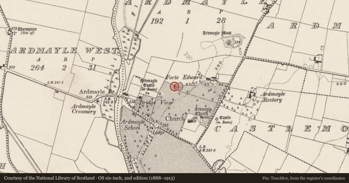
Slide toward Today to fade the historical sheet and see the modern map underneath.
David Rumsey Map Collection, Stanford LibrariesDavid Rumsey Map Collection, Stanford LibrariesDavid Rumsey Map Collection, Stanford LibrariesDavid Rumsey Map Collection, Stanford Libraries
4 historical maps cover this location, the earliest the 1790 map "Composite: Ireland." (David Rumsey Map Collection, Stanford Libraries).
Historical maps covering this location
- 1790 · Composite: Ireland. (David Rumsey Map Collection, Stanford Libraries)
- 1869 · Ireland. (David Rumsey Map Collection, Stanford Libraries)
- 1891 · Ireland 16 (David Rumsey Map Collection, Stanford Libraries)
- 1904 · Sheet 13. (David Rumsey Map Collection, Stanford Libraries)
This record in the National Monuments Service's Historic Environment Viewer ↗
The National Monuments Service's description
There are a number of architectural fragments incorporated into the masonry of a folly (TS052-034002-) on the E bank of 'Forte Edward' enclosure (TS052-034001-) and others which were incorporated into the retaining wall in the W quadrant of this enclosure and have fallen out and are strewn about the external ground level. The folly incorporates a cut limestonestone window surround (H 0.47m; Wth 0.2m) which is set vertically above the keystone of the folly. The top of the folly is surmounted by a moulded cornice (H 0.17m), visible at the NE and SE angles, which may have come from the fortified house (TS052-034011-). The fragments on the ground at the N quadrant include three chamfered limestone mullion/transom pieces (L 0.37m; Wth 0.23m; D 0.11m; chamfer Wth 9cm; visible L 0.6m; Wth 0.25m; D 0.2m; chamfer Wth 9m; L 0.27m; Wth 0.17m) and two cut limestone blocks (0.53m x 0.25m; D 0.25m), one with a chamfered edge (0.34m x 0.27m; D 0.18m; chamfer Wth 0.08m). The window surrounds appear to be from the fortified house which is located c. 200m to the W.
Compiled by: Jean Farrelly
Date of upload: 26 August 2011
Nearby in the register
- Enclosureunder 1 mi
- Designed landscape - follyunder 1 mi
- Settlement deserted - medievalunder 1 mi
- House - fortified houseunder 1 mi
Other entries of the same register within about three miles of this one, by straight line.