Sites and Monuments Record · Ireland
House - medieval
Park (Killea Par.), County Tipperary North, Ireland
The record
- Townland
- Park (Killea Par.)
- County
- Tipperary North
- Country
- Ireland
- First-edition OS map
- Not indicated
- Latest-edition OS map
- Not indicated
- Coordinates
- 52.82645, -7.87144
- SMR number
- TN029-092----
Slide toward Today to fade the historical sheet and see the modern map underneath.
David Rumsey Map Collection, Stanford LibrariesDavid Rumsey Map Collection, Stanford LibrariesDavid Rumsey Map Collection, Stanford LibrariesDavid Rumsey Map Collection, Stanford Libraries
4 historical maps cover this location, the earliest the 1790 map "Composite: Ireland." (David Rumsey Map Collection, Stanford Libraries).
Historical maps covering this location
- 1790 · Composite: Ireland. (David Rumsey Map Collection, Stanford Libraries)
- 1811 · Ireland. (David Rumsey Map Collection, Stanford Libraries)
- 1869 · Ireland. (David Rumsey Map Collection, Stanford Libraries)
- 1891 · Ireland 16 (David Rumsey Map Collection, Stanford Libraries)
This record in the National Monuments Service's Historic Environment Viewer ↗
The National Monuments Service's description
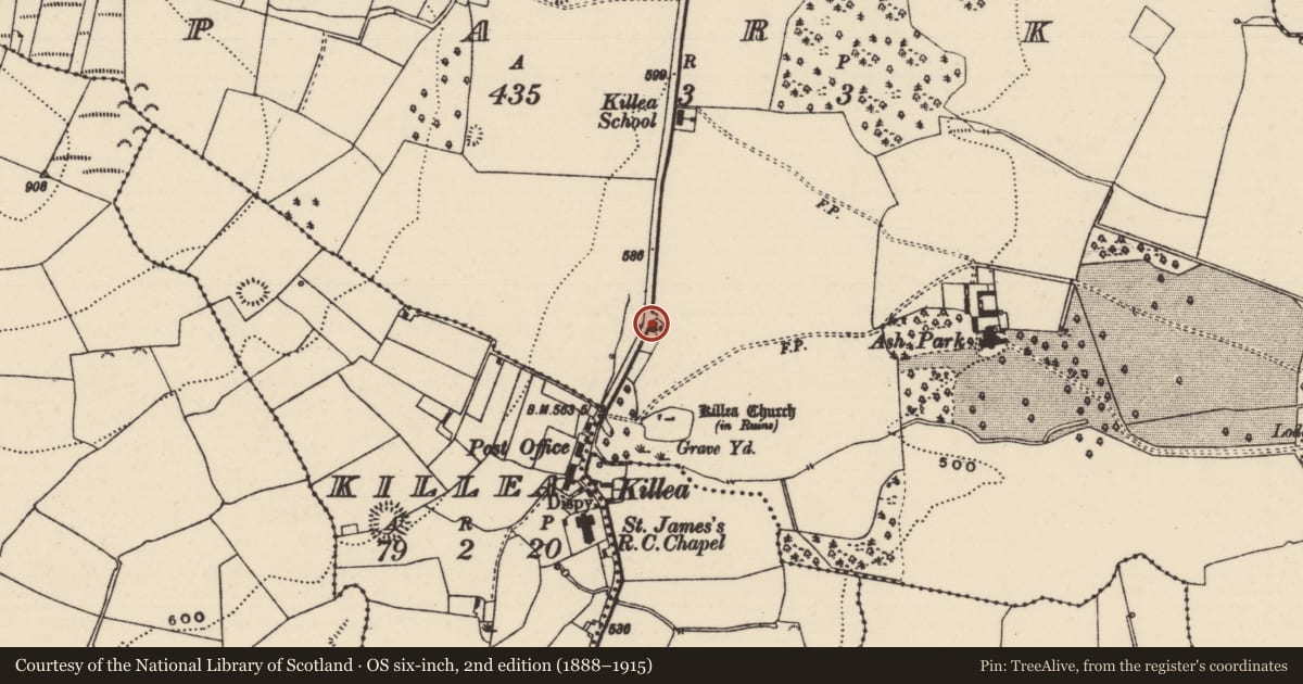
Unlocated dwelling within the townland of Park which is depicted on the 1654-56 Down Survey map of the barony of Ikerrin (NLI MS 721). On this map the dwelling is illustrated as a substantial two storey high single pile house with central chimney stack standing a short distance to the N of the church ruins (TN029-006001-) of Killea. According to local information a house known locally as the 'castle house' which contains the remains of a mural stairs may be the building depicted on the 1654-56 Down Survey map. The National Inventory of Architectural Heritage [NIAH] described 'Castle House' as a ‘freestanding square-plan castellated folly tower, built c. 1820, with roughly-dressed sandstone walls having ashlar limestone quoins and dressings. Blocked pointed window openings. Detached five-bay two-storey house to west, built c. 1820, comprising three-bay two-storey central block having castellated porch, flanked by slightly-higher single-bay two-storey blocks’ (www.buildingsofireland.ie). According to the NIAH this building was a ‘folly tower formerly related to Ash Park, a former demesne to the east’. This building is depicted as a house belonging to the 'Constabulary' on the 1840 ed. OS 6-inch map where it is shown standing on the S side of an entrance to an avenue or driveway leading from the main road to the W side or rear entrance of Ash Park.
The above description is derived from 'The Archaeological Inventory of County Tipperary. Vol. 1 - North Tipperary' compiled by Jean Farrelly and Caimin O'Brien (Dublin: Stationery Office, 2002). In certain instances the entries have been revised and updated in the light of recent research.
Compiled and revised by: Caimin O'Brien
Date of revised upload: 21 January 2015
References
NLI, MS 721 – National Library of Ireland , The parish maps of the Down Survey of County Tipperary, attested by Wm. Petty in 1657. Copied by Daniel O'Brien. A set of 67 maps with accompanying terriers, 1786-7. Dublin.
Nearby in the register
- Churchunder 1 mi
- Graveyardunder 1 mi
- Bullaun stoneunder 1 mi
- Ringfort - rathunder 1 mi
Other entries of the same register within about three miles of this one, by straight line.