Sites and Monuments Record · Ireland
House - 17th century
Abbeville, County Tipperary North, Ireland
The record
- Townland
- Abbeville
- County
- Tipperary North
- Country
- Ireland
- First-edition OS map
- NULL
- Latest-edition OS map
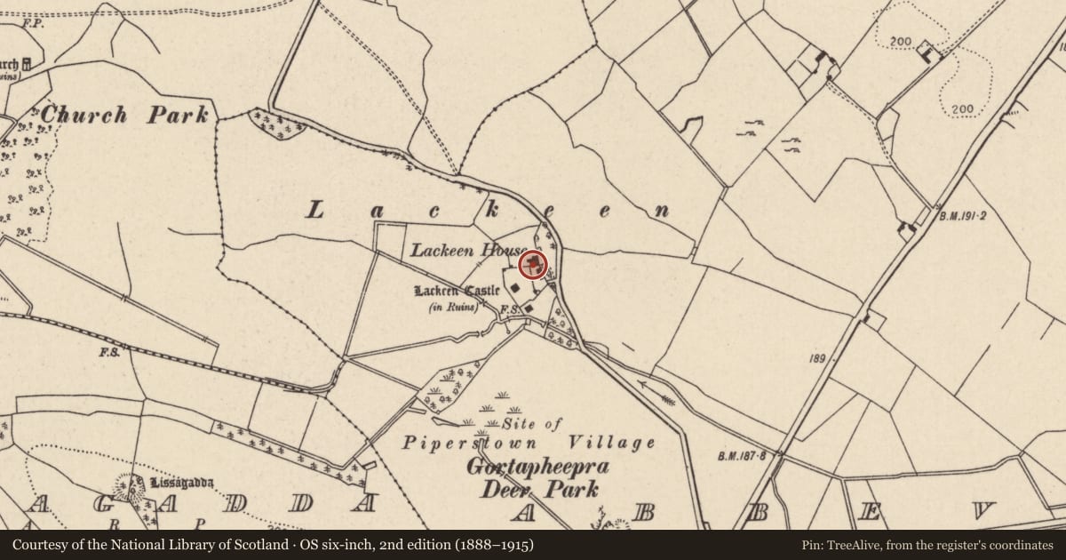
- Lackeen House
- Coordinates
- 53.08887, -8.07339
- SMR number
- TN004-022005-
Slide toward Today to fade the historical sheet and see the modern map underneath.
David Rumsey Map Collection, Stanford LibrariesDavid Rumsey Map Collection, Stanford LibrariesDavid Rumsey Map Collection, Stanford LibrariesDavid Rumsey Map Collection, Stanford Libraries
4 historical maps cover this location, the earliest the 1790 map "Composite: Ireland." (David Rumsey Map Collection, Stanford Libraries).
Historical maps covering this location
- 1790 · Composite: Ireland. (David Rumsey Map Collection, Stanford Libraries)
- 1811 · Ireland. (David Rumsey Map Collection, Stanford Libraries)
- 1869 · Ireland. (David Rumsey Map Collection, Stanford Libraries)
- 1891 · Ireland 16 (David Rumsey Map Collection, Stanford Libraries)
This record in the National Monuments Service's Historic Environment Viewer ↗
The National Monuments Service's description
The poorly preserved remains of a seventeenth-century two-storey gable-ended house (int. dims. 9m N-S; 4.2m E-W; T 1.2m) located on the external face of the NW angle of the bawn wall surrounding Lackeen tower house (TN004-022001) with an early to mid-eighteenth-century house attached to the E. Originally the seventeenth-century house consisted of a simple rectangular plan orientated on a N-S axis with a protruding gable-ended rectangular chimney stack on the N gable. The original fireplace consisted of a large wooden lintel with the cut-stone voussoirs of a relieving arch directly over. The wooden floor is carried on large beams extending E-W across the house inserted into beam-holes with smaller N-S beams traversing the larger beams. Later eighteenth-century additions to the N, E and W walls now obscure the original ground plan. The early to mid-eighteenth-century five-bay house is two storeys high with gable-ended chimneys and has a simple flat-headed doorcase and light above.
The above description is derived from 'The Archaeological Inventory of County Tipperary. Vol. 1 - North Tipperary' compiled by Jean Farrelly and Caimin O'Brien (Dublin: Stationery Office, 2002). In certain instances the entries have been revised and updated in the light of recent research.
Date of upload/revision: 22 September 2008
Nearby in the register
- Bawnunder 1 mi
- Castle - tower houseunder 1 mi
- Water mill - unclassifiedunder 1 mi
- Settlement deserted - medievalunder 1 mi
Other entries of the same register within about three miles of this one, by straight line.