Sites and Monuments Record · Ireland
Ritual site - holy well
Knockmore, County Sligo, Ireland
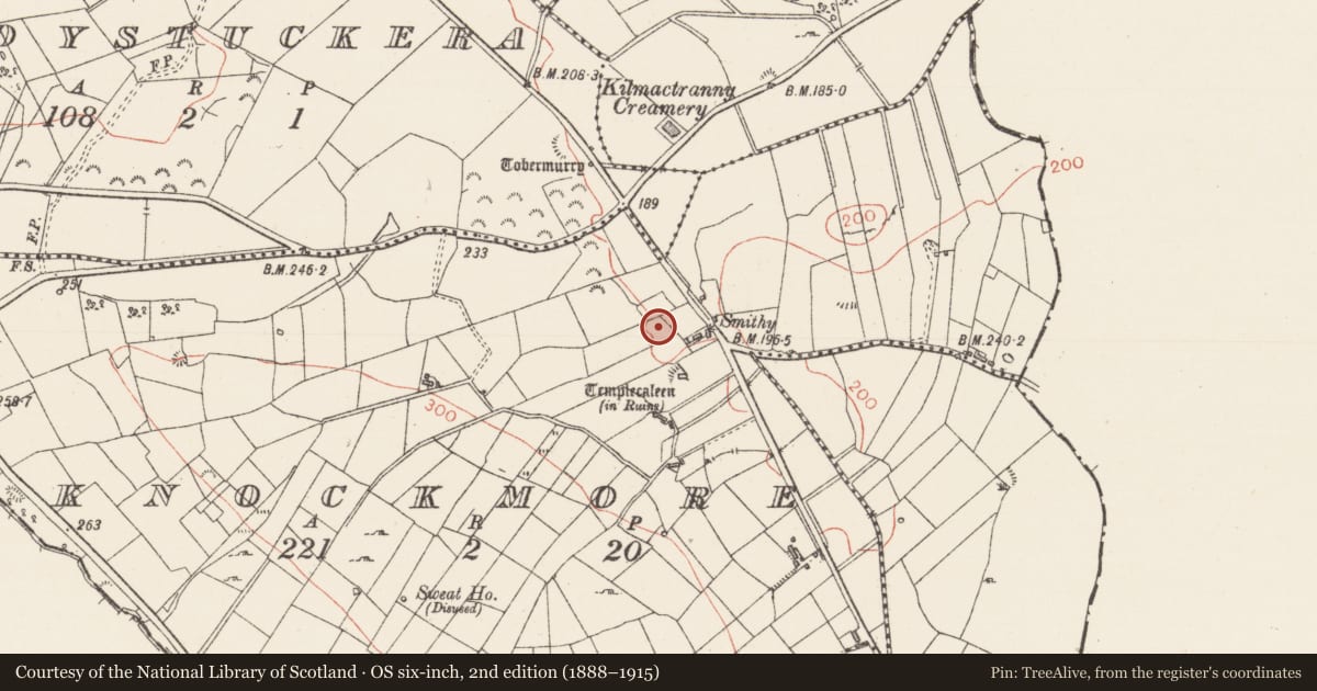
The record
- Townland
- Knockmore
- County
- Sligo
- Country
- Ireland
- First-edition OS map
- Tobercaleen (1838).
- Latest-edition OS map
- Not indicated
- Coordinates
- 54.05436, -8.24539
- SMR number
- SL041-047----
Slide toward Today to fade the historical sheet and see the modern map underneath.
David Rumsey Map Collection, Stanford LibrariesDavid Rumsey Map Collection, Stanford LibrariesDavid Rumsey Map Collection, Stanford LibrariesDavid Rumsey Map Collection, Stanford Libraries
4 historical maps cover this location, the earliest the 1790 map "Composite: Ireland." (David Rumsey Map Collection, Stanford Libraries).
Historical maps covering this location
- 1790 · Composite: Ireland. (David Rumsey Map Collection, Stanford Libraries)
- 1869 · Ireland. (David Rumsey Map Collection, Stanford Libraries)
- 1891 · Ireland 16 (David Rumsey Map Collection, Stanford Libraries)
- 1922 · Ireland - northern section. (David Rumsey Map Collection, Stanford Libraries)
This record in the National Monuments Service's Historic Environment Viewer ↗
The National Monuments Service's description
In a paddock, 50m NW of a derelict farmhouse. Named 'Tobercaleen' on the 1838 OS 6-inch map. An oval depression (2m N-S; 2.6m E-W) defined SE-NE by earth and rock (int. H 1.2m) and NE-SE by a muddy gently sloping ramp to the exterior. The base of the well is of rock and mud and holds 0.4m of water. Water is piped from it to water troughs nearby. According to local information, there are no cures associated with this well and no tradition of 'patterns' or pilgrimages. There is, however, a local tradition that it has moved from upslope to W to its present location. There is another holy well (SL041-046----) c. 200m to NW in Cloystuckera townland. Templecaleen church (SL041-048001-) is c. 90m to S. Another church (SL041-049----) lies 150m to S.
The above description is derived from the published 'Archaeological Inventory of County Sligo' compiled by Ursula Egan, Elizabeth Byrne, Mary Sleeman with Sheila Ronan and Connie Murphy (Dublin Stationery Office, 2005).
Date of upload: 18 January 2008
Nearby in the register
- Churchunder 1 mi
- Graveyardunder 1 mi
- Churchunder 1 mi
- Ritual site - holy wellunder 1 mi
Other entries of the same register within about three miles of this one, by straight line.