Sites and Monuments Record · Ireland
Ringfort - cashel
Brougher, County Sligo, Ireland
The record
- Townland
- Brougher
- County
- Sligo
- Country
- Ireland
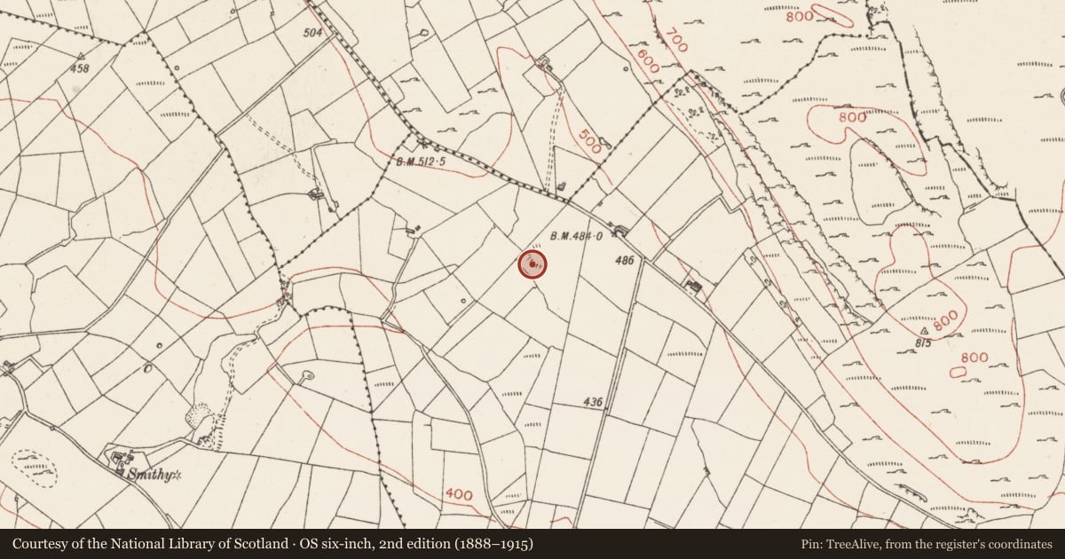
- Latest-edition OS map
- Hachured
- Coordinates
- 54.02876, -8.38803
- SMR number
- SL040-151001-
Slide toward Today to fade the historical sheet and see the modern map underneath.
David Rumsey Map Collection, Stanford LibrariesDavid Rumsey Map Collection, Stanford LibrariesDavid Rumsey Map Collection, Stanford LibrariesDavid Rumsey Map Collection, Stanford Libraries
4 historical maps cover this location, the earliest the 1790 map "Composite: Ireland." (David Rumsey Map Collection, Stanford Libraries).
Historical maps covering this location
- 1790 · Composite: Ireland. (David Rumsey Map Collection, Stanford Libraries)
- 1869 · Ireland. (David Rumsey Map Collection, Stanford Libraries)
- 1891 · Ireland 16 (David Rumsey Map Collection, Stanford Libraries)
- 1922 · Ireland - northern section. (David Rumsey Map Collection, Stanford Libraries)
This record in the National Monuments Service's Historic Environment Viewer ↗
The National Monuments Service's description
In rough grazing, on the top of a rise in the western foothills of the Bricklieve Mountains; the ground slopes down steeply to W and SW. Indicated on the 1914 OS 6-inch map by an arc of hachures S-N. An oval area (28m NE-SW; c. 37m NW-SE) defined SSW-NE by a ruined stone wall (Wth 3.5m; int. H 0.3m; ext. H 1.45m) and elsewhere by a slight undulation. The wall is moss-covered and flat-topped with a high external slump at SW to compensate for the natural slope. At intervals SSS-SW blocks of stone protrude from the wall and may be the remains of external facing. The W half of the interior is level but there is a marked slope down from the centre to E. According to local information, the enclosing wall on the E half, and much of the interior surface in the sloping E half were removed to supply building material for road construction. A linear vertical SE-facing scarp (L c. 9m; H 0.85m) extending from the NE terminal of the cashel wall into the interior is also the result of this extraction activity. A ruined field boundary wall (Wth 1.5m; H 0.3m) extends from the SW end of the scarp to the cashel wall at S. There is a possible hut site (SL040-15102-) in the W half of the interior.
The above description is derived from the published 'Archaeological Inventory of County Sligo' compiled by Ursula Egan, Elizabeth Byrne, Mary Sleeman with Sheila Ronan and Connie Murphy (Dublin Stationery Office, 2005).
Date of upload: 18 January 2008
Nearby in the register
- Hut siteunder 1 mi
- Barrow - embanked barrowunder 1 mi
- Ringfort - cashelunder 1 mi
- Crannogunder 1 mi
Other entries of the same register within about three miles of this one, by straight line.