Sites and Monuments Record · Ireland
Graveyard
Foyoges, County Sligo, Ireland
The record
- Townland
- Foyoges
- County
- Sligo
- Country
- Ireland
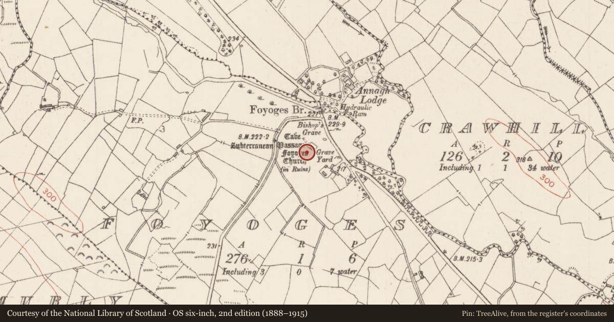
- Latest-edition OS map
- Grave Yard
- Coordinates
- 54.08807, -8.23421
- SMR number
- SL035-067002-
Slide toward Today to fade the historical sheet and see the modern map underneath.
David Rumsey Map Collection, Stanford LibrariesDavid Rumsey Map Collection, Stanford LibrariesDavid Rumsey Map Collection, Stanford LibrariesDavid Rumsey Map Collection, Stanford Libraries
4 historical maps cover this location, the earliest the 1790 map "Composite: Ireland." (David Rumsey Map Collection, Stanford Libraries).
Historical maps covering this location
- 1790 · Composite: Ireland. (David Rumsey Map Collection, Stanford Libraries)
- 1869 · Ireland. (David Rumsey Map Collection, Stanford Libraries)
- 1891 · Ireland 16 (David Rumsey Map Collection, Stanford Libraries)
- 1922 · Ireland - northern section. (David Rumsey Map Collection, Stanford Libraries)
This record in the National Monuments Service's Historic Environment Viewer ↗
The National Monuments Service's description
A rectangular area (20m NW-SE; 14m SW-NE) enclosed by a stone wall (H 1m) with a rectangular projection to the NW. Traces of a church (SL035-067001-) are evident in the W half. There is a piered entrance gate in the centre of the NE wall. The interior slopes gently down from the NE. There are a number of low uninscribed grave-markers as well as five 20th-century headstones. Two well-shaped grave-markers (H c. 0.32m; Wth 0.3m) occur in the W half, both roughly inscribed with plain crosses (H 0.32m). The graveyard is still in use. There is a souterrain (SL035-067003-) c. 20m to NW. The graveyard was referred to in 1836 as a 'burial for children and strangers called Killamy' (OSL, 237). There are no visible remains of the 'Bishop's Grave' (SL035-06704-) indicated on the 1914 OS 6-inch map c. 30m NE of the graveyard though there are praying stones (SL035-067005-) at this location.
The above description is derived from the published 'Archaeological Inventory of County Sligo' compiled by Ursula Egan, Elizabeth Byrne, Mary Sleeman with Sheila Ronan and Connie Murphy (Dublin Stationery Office, 2005).
Date of upload: 18 January 2008
Nearby in the register
- Churchunder 1 mi
- Souterrainunder 1 mi
- Burialunder 1 mi
- Ritual site - holy/saint's stoneunder 1 mi
Other entries of the same register within about three miles of this one, by straight line.