Sites and Monuments Record · Ireland
Designed landscape - avenue
Kingsborough, County Sligo, Ireland
The record
- Townland
- Kingsborough
- County
- Sligo
- Country
- Ireland
- Latest-edition OS map
- Indicated
- Coordinates
- 54.08326, -8.33445
- SMR number
- SL034-253----
Slide toward Today to fade the historical sheet and see the modern map underneath.
David Rumsey Map Collection, Stanford LibrariesDavid Rumsey Map Collection, Stanford LibrariesDavid Rumsey Map Collection, Stanford LibrariesDavid Rumsey Map Collection, Stanford Libraries
4 historical maps cover this location, the earliest the 1790 map "Composite: Ireland." (David Rumsey Map Collection, Stanford Libraries).
Historical maps covering this location
- 1790 · Composite: Ireland. (David Rumsey Map Collection, Stanford Libraries)
- 1869 · Ireland. (David Rumsey Map Collection, Stanford Libraries)
- 1891 · Ireland 16 (David Rumsey Map Collection, Stanford Libraries)
- 1922 · Ireland - northern section. (David Rumsey Map Collection, Stanford Libraries)
This record in the National Monuments Service's Historic Environment Viewer ↗
The National Monuments Service's description
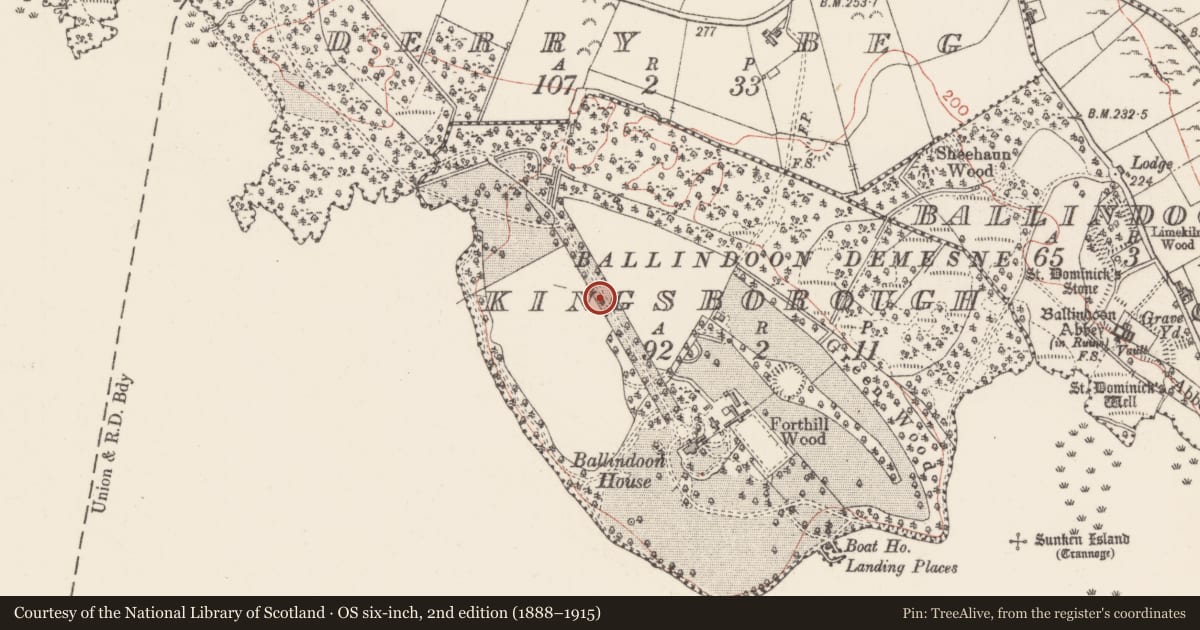
In a demesne, overlooking Lough Arrow to the S. The present early 19th-century Ballindoon House (Bence-Jones 1988, 18) is reputed to be on the site of a 17th-century house (SL034-213----) (pers. comm. M. A. Timoney). That house may have been the small rectangular structure (roughly on the site of the present house) indicated on the 1838 OS 6-inch map at the SE end of a tree-lined linear avenue (L c. 400m). This avenue (Wth 16m) is cambered and flanked on either side by a drain (Wth 2.5m; int. D 0.2m; ext. D 0.5m to the top of the external bank) with a low broad external earthen bank (Wth 2m; ext. H 0.6m). The central portion has a gravel surface but otherwise it is entirely an earthen construction. It is similar to the avenue at Annaghmore (SL026-049----) and is probably 17th/early 18th-century in date. Another house, named 'Kingsborough Ho.', which no longer survives, is indicated on the 1838 OS 6-inch map, c. 50m to the S of the present Ballindoon House. According to local information, stones from the nearby Ballindoon Castle (SL034-220001-), c. 0.9km to the SE, were taken to build Ballindoon House.
Compiled by: Archaeological Survey Unit, UCC with revisions by Patrick F. O'Donovan and Paul Walsh
Date of upload: 20 June 2011
Nearby in the register
- House - 16th/17th centuryunder 1 mi
- Ringfort - rathunder 1 mi
- Ringfort - rathunder 1 mi
- Enclosureunder 1 mi
Other entries of the same register within about three miles of this one, by straight line.