Sites and Monuments Record · Ireland
Sweathouse
Tully (Tirerrill By.), County Sligo, Ireland
The record
- Townland
- Tully (Tirerrill By.)
- County
- Sligo
- Country
- Ireland
- First-edition OS map
- Not indicated
- Latest-edition OS map
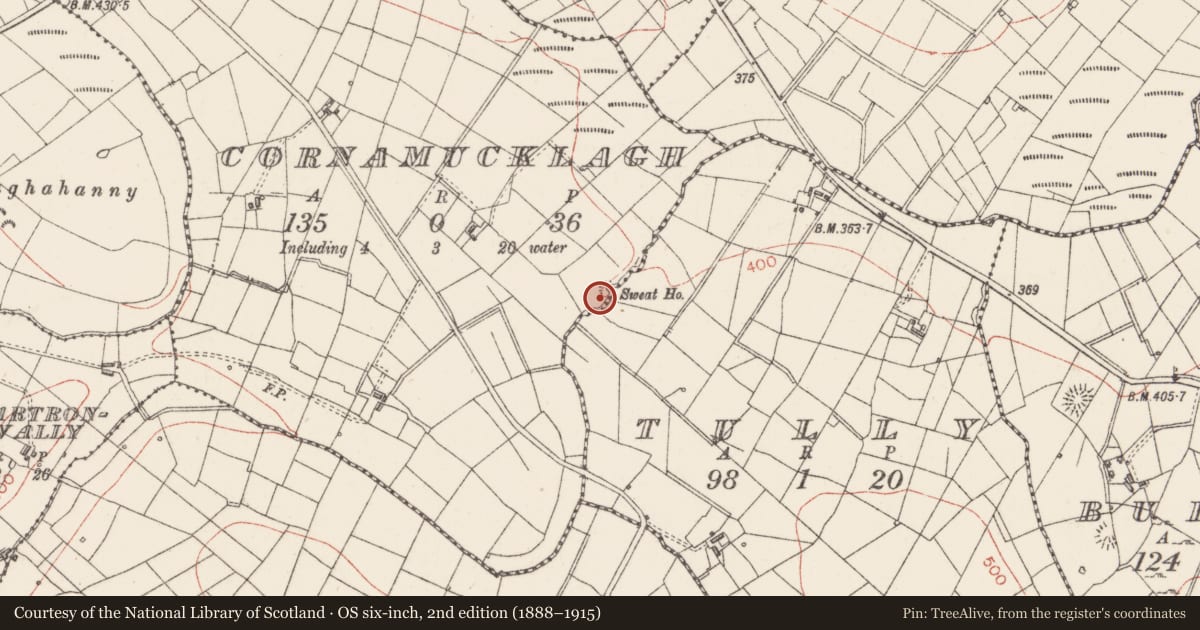
- Sweat Ho.
- Coordinates
- 54.09945, -8.31224
- SMR number
- SL034-080----
Slide toward Today to fade the historical sheet and see the modern map underneath.
David Rumsey Map Collection, Stanford LibrariesDavid Rumsey Map Collection, Stanford LibrariesDavid Rumsey Map Collection, Stanford LibrariesDavid Rumsey Map Collection, Stanford Libraries
4 historical maps cover this location, the earliest the 1790 map "Composite: Ireland." (David Rumsey Map Collection, Stanford Libraries).
Historical maps covering this location
- 1790 · Composite: Ireland. (David Rumsey Map Collection, Stanford Libraries)
- 1869 · Ireland. (David Rumsey Map Collection, Stanford Libraries)
- 1891 · Ireland 16 (David Rumsey Map Collection, Stanford Libraries)
- 1922 · Ireland - northern section. (David Rumsey Map Collection, Stanford Libraries)
This record in the National Monuments Service's Historic Environment Viewer ↗
The National Monuments Service's description
Listed in both the SMR (1989) and RMP (1995) and classsified 'Sweathouse'. In a coniferous forest on the S side of a narrow valley at a meander of a stream. The remains of the sweathouse comprise a roughly circular domed structure (diam. top 2m; diam base 6m; H 2m) with a rectangular opening (Wth 0.45m; H 0.6m; D 0.4m) on the N side facing the stream. It is constructed of rubble limestone in rough courses, bonded with lime mortar. The splayed lintelled opening, which is flush with the external wall face, has jambs of roughly shaped limestone blocks. Internally there is a single rectangular cell (1.8m N-S; 1.7m E-W; H 1.6tm) with a corbelled roof and a level floor of packed earth. The internal surface of the wall, which is unrendered, is faced with shaped limestone rubble bonded with lime mortar. The sweathouse is overgrown with briars. It is marked on the 1914 edition of the OS 6-inch map but not on the 1838 edition, an indicator that it is probably 19th century in date.
Compiled by: Archaeological Survey Unit, UCC
Date of upload: 04 January 2012
Nearby in the register
- Sweathouseunder 1 mi
- Ringfort - rathunder 1 mi
- Ringfort - rathunder 1 mi
- Ringfort - rathunder 1 mi
Other entries of the same register within about three miles of this one, by straight line.