Sites and Monuments Record · Ireland
Religious house - Knights Templars
Templehouse Demesne, County Sligo, Ireland
The record
- Townland
- Templehouse Demesne
- County
- Sligo
- Country
- Ireland
- Latest-edition OS map
- Not indicated
- Coordinates
- 54.11186, -8.58509
- SMR number
- SL033-026007-
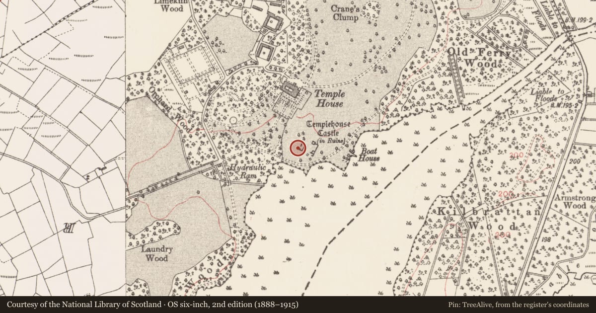
Slide toward Today to fade the historical sheet and see the modern map underneath.
David Rumsey Map Collection, Stanford LibrariesDavid Rumsey Map Collection, Stanford LibrariesDavid Rumsey Map Collection, Stanford LibrariesDavid Rumsey Map Collection, Stanford Libraries
4 historical maps cover this location, the earliest the 1790 map "Composite: Ireland." (David Rumsey Map Collection, Stanford Libraries).
Historical maps covering this location
- 1790 · Composite: Ireland. (David Rumsey Map Collection, Stanford Libraries)
- 1841 · Ireland. (David Rumsey Map Collection, Stanford Libraries)
- 1869 · Ireland. (David Rumsey Map Collection, Stanford Libraries)
- 1891 · Ireland 16 (David Rumsey Map Collection, Stanford Libraries)
This record in the National Monuments Service's Historic Environment Viewer ↗
The National Monuments Service's description
According to Gwynn and Hadcock (1970, 330-31), there was a Knights Templers foundation at Templehouse. The evidence indicates that Temple House Castle (SL033-026001-) and its lands formed a preceptory and manor belonging to the Knights Templar from some time before 1271 to the order’s suppression in 1312 (O’Conor and Nassens 2016, 127).There is a complex of ruinded monuments at this location (see SL033-026001-; SL033-026002-; SL033-026003-; SL033-026004-) including the base of an early medieval high cross (SL033-026005-) lying on the ground within the hall-house (SL033-026001-). (Ó Muraíle 2002, 240 n. 24; Egan et al. 2005, no. 2671)
Revised by: Paul Walsh
Revised date of upload: 14 December 2015
References
Ó Muraíle, N. 2002 Downing's description of county Sligo, c. 1684. In M.A. Timoney (ed.), A celebration of Sligo: first essays for Sligo Field Club, 231-42. Sligo Field Club.
Egan, U., Byrne, E., Sleeman, M. 2005 Archaeological Inventory of County Sligo, Vol. 1: South Sligo. Dublin. Stationery Office.
Nearby in the register
- Castle - hall-houseunder 1 mi
- Cross - High crossunder 1 mi
- Architectural fragmentunder 1 mi
- Bawnunder 1 mi
Other entries of the same register within about three miles of this one, by straight line.