Sites and Monuments Record · Ireland
Ringfort - rath
Rosses Upper, County Sligo, Ireland
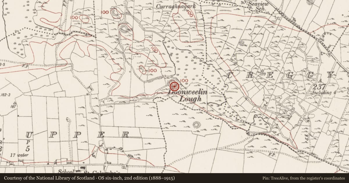
The record
- Townland
- Rosses Upper
- County
- Sligo
- Country
- Ireland
- Coordinates
- 54.31171, -8.54739
- SMR number
- SL008-104001-
Slide toward Today to fade the historical sheet and see the modern map underneath.
David Rumsey Map Collection, Stanford LibrariesDavid Rumsey Map Collection, Stanford LibrariesDavid Rumsey Map Collection, Stanford LibrariesDavid Rumsey Map Collection, Stanford Libraries
4 historical maps cover this location, the earliest the 1790 map "Composite: Ireland." (David Rumsey Map Collection, Stanford Libraries).
Historical maps covering this location
- 1790 · Composite: Ireland. (David Rumsey Map Collection, Stanford Libraries)
- 1869 · Ireland. (David Rumsey Map Collection, Stanford Libraries)
- 1891 · Ireland 16 (David Rumsey Map Collection, Stanford Libraries)
- 1904 · Sheet 4. (David Rumsey Map Collection, Stanford Libraries)
This record in the National Monuments Service's Historic Environment Viewer ↗
The National Monuments Service's description
Situated on a slight rise in undulating rocky pasture immediately to S of steep NE facing slope overlooking Doonweelin Lough to NE. Oval raised area (dims. 24m NW-SE; 18m NE-SW) enclosed by a substantial bank of earth and stone (Wth 4m; int. H 0.6m; ext. H 4m). At the external base of the bank are a broad flat-bottomed fosse (Wth 6.5m) and an external broad flat-topped bank of earth and stone (Wth 3.6m; int. H 1.3m). From NW-E the fosse and external bank are absent where a very steep 4m high natural NE facing slope breaks immediately outside the base of the internal bank. A break (Wth 4m) in the internal bank, a causeway across the fosse and a corresponding break in the external bank at SE marks the position of the original entrance. A second entrance appears to have been located at NW where there is a causeway (Wth 2-3m) across the fosse but no break is visible in the internal bank. There is a modern break (Wth 4m) in the external bank at SW. The remains of an enclosure (SL008-104002-) and a hut site (SL008-104003-) are located on the S side of the interior against the inner face of the bank.
Compiled by: Patrick F. O'Donovan
Date of upload: 21 April 2011
Nearby in the register
- Hut siteunder 1 mi
- Enclosureunder 1 mi
- Barrow - ring-barrowunder 1 mi
- Ringfort - rathunder 1 mi
Other entries of the same register within about three miles of this one, by straight line.