Sites and Monuments Record · Ireland
Ringfort - cashel
Castlegal (Carbury By., Cliffony North ED), County Sligo, Ireland
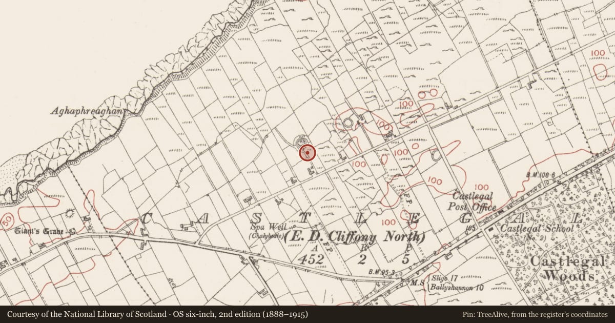
The record
- Townland
- Castlegal (Carbury By., Cliffony North ED)
- County
- Sligo
- Country
- Ireland
- Latest-edition OS map
- Indicated
- Coordinates
- 54.45743, -8.40490
- SMR number
- SL003-006----
Slide toward Today to fade the historical sheet and see the modern map underneath.
David Rumsey Map Collection, Stanford LibrariesDavid Rumsey Map Collection, Stanford LibrariesDavid Rumsey Map Collection, Stanford LibrariesDavid Rumsey Map Collection, Stanford Libraries
4 historical maps cover this location, the earliest the 1881 map "Ireland to Illustrate the Military Condition of the Country." (David Rumsey Map Collection, Stanford Libraries).
Historical maps covering this location
- 1881 · Ireland to Illustrate the Military Condition of the Country. (David Rumsey Map Collection, Stanford Libraries)
- 1891 · Ireland 16 (David Rumsey Map Collection, Stanford Libraries)
- 1904 · Sheet 4. (David Rumsey Map Collection, Stanford Libraries)
- 1922 · Ireland - northern section. (David Rumsey Map Collection, Stanford Libraries)
This record in the National Monuments Service's Historic Environment Viewer ↗
The National Monuments Service's description
Situated on summit of a narrow NE-SW orientated ridge in gently undulating pasture. Slightly raised circular area (dims. 25.5m N-S; c. 26m E-W) enclosed by a drystone wall (int. H 0.65m; ext. H 1.55m; T 1.45m). From W-E a second concentric external wall, now beneath a modern drystone field wall (H 0.55, T 0.55m), lies 8m outside the internal wall. There is no trace of a fosse at ground level. The internal wall is made up of un-coursed, un-mortared rubble limestone. Larger blocks of limestone (dims. up to 1.5m by 1.5m) act as basal foundations on the external side of the wall. From NE- E, the internal wall has been removed down to the footings. The original entrance is not recognisable and the breaks at S (Wth 3.5m) and at NNW (Wth 1.2m) appear to be modern. A modern roughly metalled path (Wth 5m) skirts the base of the internal wall S-W. A portion of the NE side of the interior is defined by a NW-SE orientated relic drystone field wall that meets the inner side of the internal wall at N and E.
Compiled by: Patrick F. O'Donovan
Date of upload: 21 April 2011
Nearby in the register
- Ringfort - cashelunder 1 mi
- Ringfort - cashelunder 1 mi
- Ringfort - cashelunder 1 mi
- Ringfort - cashelunder 1 mi
Other entries of the same register within about three miles of this one, by straight line.