Sites and Monuments Record · Ireland
Building
Warren, County Roscommon, Ireland
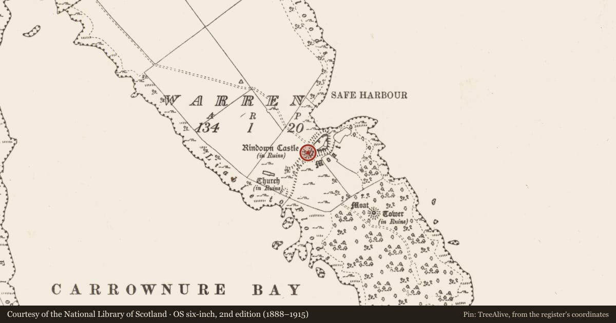
The record
- Townland
- Warren
- County
- Roscommon
- Country
- Ireland
- First-edition OS map
- Indicated
- Latest-edition OS map
- Indicated
- Coordinates
- 53.53865, -7.99154
- SMR number
- RO046-004017-
Slide toward Today to fade the historical sheet and see the modern map underneath.
David Rumsey Map Collection, Stanford LibrariesDavid Rumsey Map Collection, Stanford LibrariesDavid Rumsey Map Collection, Stanford LibrariesDavid Rumsey Map Collection, Stanford Libraries
4 historical maps cover this location, the earliest the 1790 map "Composite: Ireland." (David Rumsey Map Collection, Stanford Libraries).
Historical maps covering this location
- 1790 · Composite: Ireland. (David Rumsey Map Collection, Stanford Libraries)
- 1811 · Ireland. (David Rumsey Map Collection, Stanford Libraries)
- 1869 · Ireland. (David Rumsey Map Collection, Stanford Libraries)
- 1891 · Ireland 16 (David Rumsey Map Collection, Stanford Libraries)
This record in the National Monuments Service's Historic Environment Viewer ↗
The National Monuments Service's description
A hall, perhaps the 'new hall' built in 1299-1302, is attached to the outer face of the S ward wall of the castle ward at the W end. It is a rectangular structure (int. dims 14.45m NE-SW; 5.6m NW-SE) of two floors which was entered at the first floor from the wall-walk level of the ward of the castle, although this wall is destroyed apart from a single chamfered doorjamb. The N end of the SE wall is rebuilt with three gun-loops at the ground floor, and there are four inserted gun-loops elsewhere at the ground floor, including one in a blocked round-headed doorway (Wth 0.8m; H 2.05m) at the S end of the NW wall. The first floor has a fireplace in the SE wall, and evidence of five embrasures, two in each long wall including one with a lancet window in the NW wall. This floor also has a round-headed doorway (Wth 0.7m; H 2.2m) with a long draw-bar socket (L 2m plus) in the N jamb at the S end of the NW wall. This doorway, which is above a similar blocked one on the ground floor is interpreted by O’Conor (et al. 2014, 320) as leading to a timber garderobe tower, and they point out that there is a platform beneath in the fosse to provide its foundation.
Compiled by: Michael Moore
Date of revised upload: 29 April, 2015
References
O'Conor, K., Naessens, P. and R. Sherlock 2014 Rindoon castle, Co. Roscommon: a border castle on the Irish frontier. Chateau Gaillard 26, 313-23.
Nearby in the register
- Gatehouseunder 1 mi
- Castle - Anglo-Norman masonry castleunder 1 mi
- Naustunder 1 mi
- Linear earthworkunder 1 mi
Other entries of the same register within about three miles of this one, by straight line.