Sites and Monuments Record · Ireland
Gatehouse
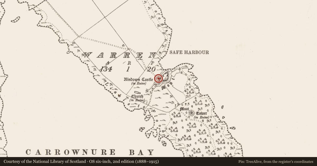
Warren, County Roscommon, Ireland
The record
- Townland
- Warren
- County
- Roscommon
- Country
- Ireland
- First-edition OS map
- Not indicated
- Latest-edition OS map
- Not indicated
- Coordinates
- 53.53882, -7.99148
- SMR number
- RO046-004015-
Slide toward Today to fade the historical sheet and see the modern map underneath.
David Rumsey Map Collection, Stanford LibrariesDavid Rumsey Map Collection, Stanford LibrariesDavid Rumsey Map Collection, Stanford LibrariesDavid Rumsey Map Collection, Stanford Libraries
4 historical maps cover this location, the earliest the 1790 map "Composite: Ireland." (David Rumsey Map Collection, Stanford Libraries).
Historical maps covering this location
- 1790 · Composite: Ireland. (David Rumsey Map Collection, Stanford Libraries)
- 1811 · Ireland. (David Rumsey Map Collection, Stanford Libraries)
- 1869 · Ireland. (David Rumsey Map Collection, Stanford Libraries)
- 1891 · Ireland 16 (David Rumsey Map Collection, Stanford Libraries)
This record in the National Monuments Service's Historic Environment Viewer ↗
The National Monuments Service's description
The ward of Rindown Castle (RO046-004002-) was entered by a gatehouse towards the S end of the NW side. The gatehouse (ext. dims 5.2m NE-SW; 3.5m NW-SE) projects outside the wall and has a complete outer rounded limestone arch (Wth 2.3m; H 3.3m) dressed with diagonal tooling. The outer pier has a portcullis niche, but the upper floor of the gatehouse, which does not survive, would have been accessible from the first floor of the keep which is just to the N by means of a pointed doorway from the keep, and from the first floor of the hall (RO046-004017-), just to the S.
See the attached view taken from the NW.
Compiled by: Michael Moore
Date of upload: 24 August 2010
Nearby in the register
- Castle - Anglo-Norman masonry castleunder 1 mi
- Buildingunder 1 mi
- Naustunder 1 mi
- House - indeterminate dateunder 1 mi
Other entries of the same register within about three miles of this one, by straight line.