Sites and Monuments Record · Ireland
Promontory fort - inland
Warren, County Roscommon, Ireland
The record
- Townland
- Warren
- County
- Roscommon
- Country
- Ireland
- First-edition OS map
- Indicated
- Latest-edition OS map
- Hachured
- Coordinates
- 53.53775, -7.99223
- SMR number
- RO046-004001-
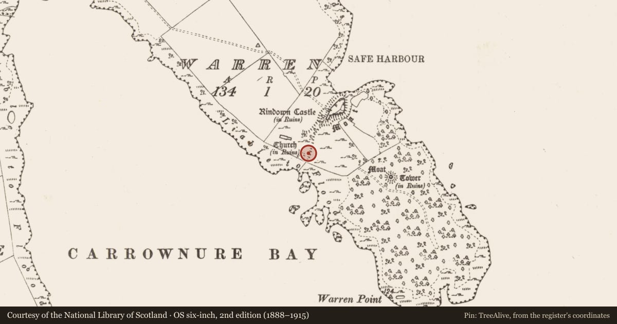
Slide toward Today to fade the historical sheet and see the modern map underneath.
David Rumsey Map Collection, Stanford LibrariesDavid Rumsey Map Collection, Stanford LibrariesDavid Rumsey Map Collection, Stanford LibrariesDavid Rumsey Map Collection, Stanford Libraries
4 historical maps cover this location, the earliest the 1790 map "Composite: Ireland." (David Rumsey Map Collection, Stanford Libraries).
Historical maps covering this location
- 1790 · Composite: Ireland. (David Rumsey Map Collection, Stanford Libraries)
- 1811 · Ireland. (David Rumsey Map Collection, Stanford Libraries)
- 1869 · Ireland. (David Rumsey Map Collection, Stanford Libraries)
- 1891 · Ireland 16 (David Rumsey Map Collection, Stanford Libraries)
This record in the National Monuments Service's Historic Environment Viewer ↗
The National Monuments Service's description
At a point where the bay of Safe Harbour (RO046-004011-) impinges on the NE shore of Rindown peninsula. A bank and fosse extend NE-SW across the peninsula to a pond close to the SW shore (L c. 200m). Its N end is incorporated into the defences of the castle (RO046-004002-), but its S end consists of a broad bank (L c. 100m; Wth 8.5m; int. H at SE 1.1m; ext. H 2m) and a flat-bottomed fosse (Wth of top 18m; Wth of base 11.5m; D 1.5m). The bank declines towards the SW end (Wth 4m; int. H 0.5m; ext. H 1.3m), but the defences enclose c. 20 ha to the SE. The wall (RO046-004018-) is built just to the SE of the bank and parallel with it. The fosse and bank are interpreted by O’Conor et al. (2014, 315-6) as possibly representing the SE edge of the town and providing a boundary with demesne land associated with the castle (RO046-004002-) at the tip of the peninsula.
Compiled by: Michael Moore
Date of upload: 29 April 2015
References
O'Conor, K., Naessens, P. and R. Sherlock 2014 Rindoon castle, Co. Roscommon: a border castle on the Irish frontier. Chateau Gaillard 26, 313-23.
Nearby in the register
- Linear earthworkunder 1 mi
- Churchyardunder 1 mi
- Churchunder 1 mi
- Buildingunder 1 mi
Other entries of the same register within about three miles of this one, by straight line.