Sites and Monuments Record · Ireland
Barrow - ring-barrow
Toberrory, County Roscommon, Ireland
The record
- Townland
- Toberrory
- County
- Roscommon
- Country
- Ireland
- First-edition OS map
- Not indicated
- Latest-edition OS map
- Not indicated
- Coordinates
- 53.80225, -8.30232
- SMR number
- RO022-057013-
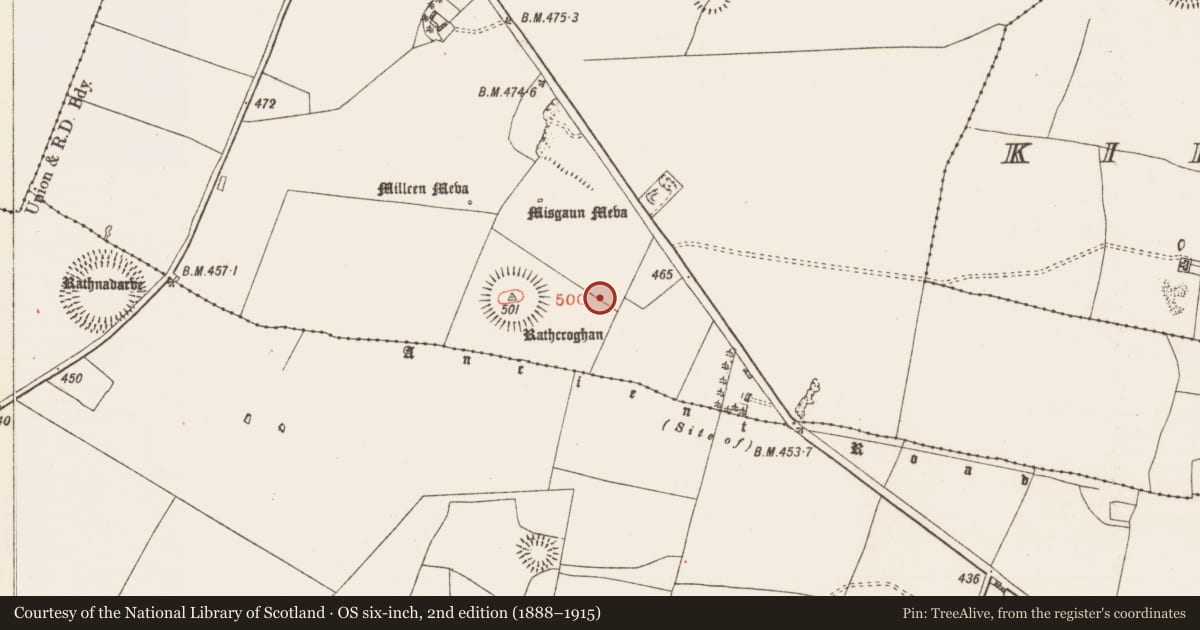
Slide toward Today to fade the historical sheet and see the modern map underneath.
David Rumsey Map Collection, Stanford LibrariesDavid Rumsey Map Collection, Stanford LibrariesDavid Rumsey Map Collection, Stanford LibrariesDavid Rumsey Map Collection, Stanford Libraries
4 historical maps cover this location, the earliest the 1790 map "Composite: Ireland." (David Rumsey Map Collection, Stanford Libraries).
Historical maps covering this location
- 1790 · Composite: Ireland. (David Rumsey Map Collection, Stanford Libraries)
- 1811 · Ireland. (David Rumsey Map Collection, Stanford Libraries)
- 1869 · Ireland. (David Rumsey Map Collection, Stanford Libraries)
- 1891 · Ireland 16 (David Rumsey Map Collection, Stanford Libraries)
This record in the National Monuments Service's Historic Environment Viewer ↗
The National Monuments Service's description
On the Rathcroghan plateau, c. 70m E of Rathcroghan mound (RO022-057010-) and centrally placed between the arms of the avenue (RO022-057093-). Circular area (int. diam. 7m) defined by a parch mark (Wth 2m) visible in drought conditions. Geophysical survey confirms that it has a fosse and external bank (max. ext. diam. c. 12m), and probably pre-dates ring-barrow (RO022-057014-) which is immediately to the S (Waddell et al. 2009, 151-2, 193). (Herity 1983, 130; 1988, 129, Toberrory 16; Waddell 1983, 29, No. 5)
This is a National Monument in state ownership: No. 294.
Compiled by: Michael Moore
Date of upload: 24 August 2010
References
Herity, M. 1983 A survey of the royal site of Cruachain in Connacht, 1. Introduction, the monuments and topography. Journal of the Royal Society of Antiquaries of Ireland 113, 121-42.
Waddell, J., Fenwick, J. and Barton, K. 2009 Rathcroghan: archaeological and geophysical survey in a ritual landscape. Dublin. Wordwell.
Waddell, J. 1983 Rathcroghan - a royal site in Connaught. Journal of Irish Archaeology 1, 21-46.
Nearby in the register
- Barrow - ring-barrowunder 1 mi
- Linear earthworkunder 1 mi
- Linear earthworkunder 1 mi
- Enclosureunder 1 mi
Other entries of the same register within about three miles of this one, by straight line.