Sites and Monuments Record · Ireland
Cairn - unclassified
Rockville, County Roscommon, Ireland
The record
- Townland
- Rockville
- County
- Roscommon
- Country
- Ireland
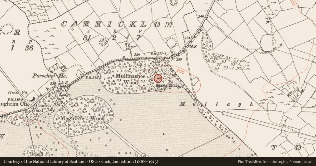
- First-edition OS map
- Giants Grave
- Latest-edition OS map
- Giants Grave
- Coordinates
- 53.87654, -8.09184
- SMR number
- RO017-089002-
Slide toward Today to fade the historical sheet and see the modern map underneath.
David Rumsey Map Collection, Stanford LibrariesDavid Rumsey Map Collection, Stanford LibrariesDavid Rumsey Map Collection, Stanford LibrariesDavid Rumsey Map Collection, Stanford Libraries
4 historical maps cover this location, the earliest the 1790 map "Composite: Ireland." (David Rumsey Map Collection, Stanford Libraries).
Historical maps covering this location
- 1790 · Composite: Ireland. (David Rumsey Map Collection, Stanford Libraries)
- 1811 · Ireland. (David Rumsey Map Collection, Stanford Libraries)
- 1869 · Ireland. (David Rumsey Map Collection, Stanford Libraries)
- 1891 · Ireland 16 (David Rumsey Map Collection, Stanford Libraries)
This record in the National Monuments Service's Historic Environment Viewer ↗
The National Monuments Service's description
On top of a drumlin and within a mixed woodland called Mullinashee Wood which had been recently cut in 1996. Circular, round-topped cairn (diam. 25m; H 3.2m) within the ceremonial enclosure (RO017-089001-). It is listed as a possible passage tomb (Ó Nualláin 1968, 26) although there is no evidence of a kerb or passage. (de Valera and Ó Nualláin 1972, 141)
Compiled by: Michael Moore
Date of upload: 24 August 2010
See linked document with details from Ruaidhrí de Valera and Seán Ó Nualláin, Survey of the Megalithic Tombs of Ireland. Volume III. Counties Galway, Roscommon, Leitrim, Longford, Westmeath, Laoighis, Offaly, Kildare, Cavan. (Dublin: Stationery Office, 1972).
References
Ó Nualláin, S. 1968 A ruined megalithic cemetery in Co. Donegal and its context in the Irish passage grave series. Journal of the Royal Society of Antiquaries of Ireland 98, 1-29.
de Valera, R. and Ó Nualláin, S. 1972 Survey of the megalithic tombs of Ireland, vol. 3, Counties Galway, Roscommon, Leitrim, Longford, Westmeath, Laoighis, Offaly, Kildare, Cavan. Dublin. Stationery Office.
Nearby in the register
- Ceremonial enclosureunder 1 mi
- Ringfort - rathunder 1 mi
- Earthworkunder 1 mi
- Ringfort - rathunder 1 mi
Other entries of the same register within about three miles of this one, by straight line.