Sites and Monuments Record · Ireland
Enclosure
Cloongownagh, County Roscommon, Ireland
The record
- Townland
- Cloongownagh
- County
- Roscommon
- Country
- Ireland
- First-edition OS map
- Not indicated
- Latest-edition OS map
- Not indicated
- Coordinates
- 53.94889, -8.14349
- SMR number
- RO011-160002-
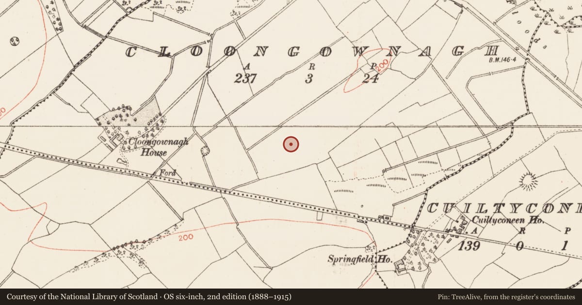
Slide toward Today to fade the historical sheet and see the modern map underneath.
David Rumsey Map Collection, Stanford LibrariesDavid Rumsey Map Collection, Stanford LibrariesDavid Rumsey Map Collection, Stanford LibrariesDavid Rumsey Map Collection, Stanford Libraries
4 historical maps cover this location, the earliest the 1790 map "Composite: Ireland." (David Rumsey Map Collection, Stanford Libraries).
Historical maps covering this location
- 1790 · Composite: Ireland. (David Rumsey Map Collection, Stanford Libraries)
- 1811 · Ireland. (David Rumsey Map Collection, Stanford Libraries)
- 1869 · Ireland. (David Rumsey Map Collection, Stanford Libraries)
- 1891 · Ireland 16 (David Rumsey Map Collection, Stanford Libraries)
This record in the National Monuments Service's Historic Environment Viewer ↗
The National Monuments Service's description
On a slight S-facing slope. Excavation (99E0193) in 1999-2000 (Henry 2000c; Lennon and Henry 2001, vol. 1, 64) of an extensive area (dims 120m NW-SE; c. 55m NE-SW) included the S part of rath (RO011-160001). A rectangular enclosure or annexe (dims 25m NW-SE; 16m plus NE-W) defined by a fosse (Wth c. 1.2m; D c. 0.55m) with traces of an internal bank was attached to the SE. It post-dates the silting of the rath fosse and produced a C14 date in the late 12th or 13th century, although the sample may have been contaminated. No structures were associated with the annexe.
Compiled by: Michael Moore
Date of upload: 24 August 2010
References
Lennon, A.M. and Henry, M. 2001 Archaeological report on the excavation at Cloongownagh, Carrick-on-Shannon, Co. Roscommon. Mary Henry Archaeological Services. Unpublished report, National Monuments Section, Heritage and Planning Division, Department of Environment, Heritage and Local Government, Dublin. Licence no. 99E0193.
Henry, M. 2000c Cloongownagh enclosure. In I. Bennett (ed.), Excavations 1999: summary accounts of archaeological excavations in Ireland, 268, No. 765. Bray. Wordwell.
Nearby in the register
- Fulacht fiaunder 1 mi
- Ringfort - rathunder 1 mi
- Hut siteunder 1 mi
- House - prehistoricunder 1 mi
Other entries of the same register within about three miles of this one, by straight line.