Sites and Monuments Record · Ireland
Barrow - ring-barrow
Clonin, County Offaly, Ireland
The record
- Townland
- Clonin
- County
- Offaly
- Country
- Ireland
- First-edition OS map
- Not indicated
- Latest-edition OS map
- Not indicated
- Coordinates
- 53.35205, -7.21060
- SMR number
- OF011-001002-
Slide toward Today to fade the historical sheet and see the modern map underneath.
David Rumsey Map Collection, Stanford LibrariesDavid Rumsey Map Collection, Stanford LibrariesDavid Rumsey Map Collection, Stanford LibrariesDavid Rumsey Map Collection, Stanford Libraries
4 historical maps cover this location, the earliest the 1790 map "Composite: Ireland." (David Rumsey Map Collection, Stanford Libraries).
Historical maps covering this location
- 1790 · Composite: Ireland. (David Rumsey Map Collection, Stanford Libraries)
- 1811 · Ireland. (David Rumsey Map Collection, Stanford Libraries)
- 1869 · Ireland. (David Rumsey Map Collection, Stanford Libraries)
- 1891 · Ireland 16 (David Rumsey Map Collection, Stanford Libraries)
This record in the National Monuments Service's Historic Environment Viewer ↗
The National Monuments Service's description
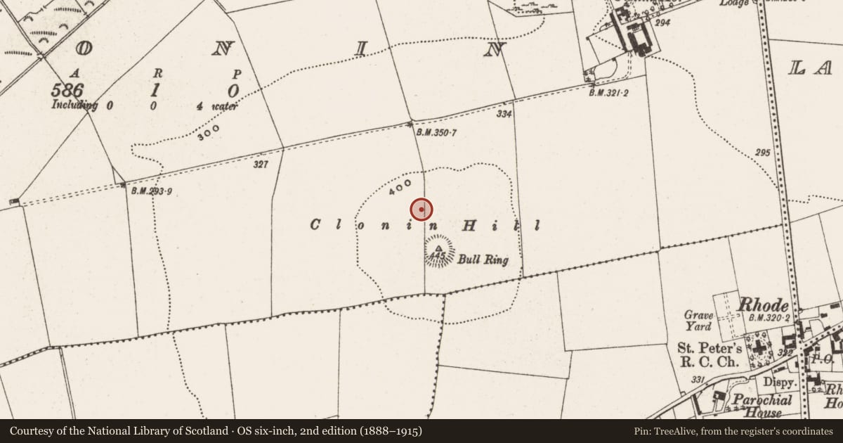
National Monument No. 532. In pasture on top of Clonin Hill with extensive views of the surrounding countryside. Impressive view of burial mound (OF010-004001-) on top of Croghan Hill 4.5km to W. Smaller ring-barrow (OF011-001002-) now levelled located c. 20 metres to NW of ring-barrow (OF011-001----). No surface remains visible. Described in 1970 as following: 'Approx. 56m NW from centre of the barrow is a smaller barrow divided in two by a modern field fence wall. This smaller barrow measures 11m approx. in overall width, with the fosse measuring 3m in width' (SMR File 23/01/1970)'. The field boundary described in 1970 and indicated on all editions of the OS 6-inch maps has been removed in recent times and the ring-barrow was probably levelled when the field boundary was removed.
The above description is derived from the published 'Archaeological Inventory of County Offaly' (Dublin: Stationery Office, 1997). In certain instances the entries have been revised and updated in the light of recent research.
Compiled by: Caimin O'Brien
Date of upload: 25 January 2016
Nearby in the register
- Barrow - ring-barrowunder 1 mi
- Mass-rockunder 1 mi
- Cross - Wayside cross (present location)under 1 mi
- Platform - peatlandunder 1 mi
Other entries of the same register within about three miles of this one, by straight line.