Sites and Monuments Record · Ireland
Mass-rock
Clonin, County Offaly, Ireland
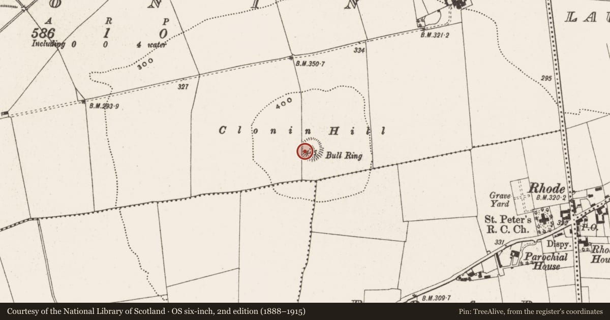
The record
- Townland
- Clonin
- County
- Offaly
- Country
- Ireland
- First-edition OS map
- Not indicated
- Latest-edition OS map
- Not indicated
- Coordinates
- 53.35124, -7.21035
- SMR number
- OF011-001001-
Slide toward Today to fade the historical sheet and see the modern map underneath.
David Rumsey Map Collection, Stanford LibrariesDavid Rumsey Map Collection, Stanford LibrariesDavid Rumsey Map Collection, Stanford LibrariesDavid Rumsey Map Collection, Stanford Libraries
4 historical maps cover this location, the earliest the 1790 map "Composite: Ireland." (David Rumsey Map Collection, Stanford Libraries).
Historical maps covering this location
- 1790 · Composite: Ireland. (David Rumsey Map Collection, Stanford Libraries)
- 1811 · Ireland. (David Rumsey Map Collection, Stanford Libraries)
- 1869 · Ireland. (David Rumsey Map Collection, Stanford Libraries)
- 1891 · Ireland 16 (David Rumsey Map Collection, Stanford Libraries)
This record in the National Monuments Service's Historic Environment Viewer ↗
The National Monuments Service's description
National Monument No. 532. In pasture on top of Clonin Hill with extensive views of the surrounding countryside. Impressive view of burial mound (OF010-004001-) on top of Croghan Hill 4.5km to W. Natural rock outcrop (H 0.6m x 1.4m x 1.6m) known locally as a mass-rock (SMR File) in SW quadrant of fosse of ring-barrow (OF011-001----). The weathered NW facing surface of the rock contains features of natural weathering except for two horseshoe-shaped symbols and a cross with expanded terminals (SMR File).
Compiled by: Caimin O'Brien
Date of upload: 25 January 2016
Nearby in the register
- Barrow - ring-barrowunder 1 mi
- Barrow - ring-barrowunder 1 mi
- Cross - Wayside cross (present location)under 1 mi
- Platform - peatlandunder 1 mi
Other entries of the same register within about three miles of this one, by straight line.