Sites and Monuments Record · Ireland
Megalithic tomb - court tomb
Tiredigan, County Monaghan, Ireland
The record
- Townland
- Tiredigan
- County
- Monaghan
- Country
- Ireland
- First-edition OS map
- Not indicated
- Latest-edition OS map
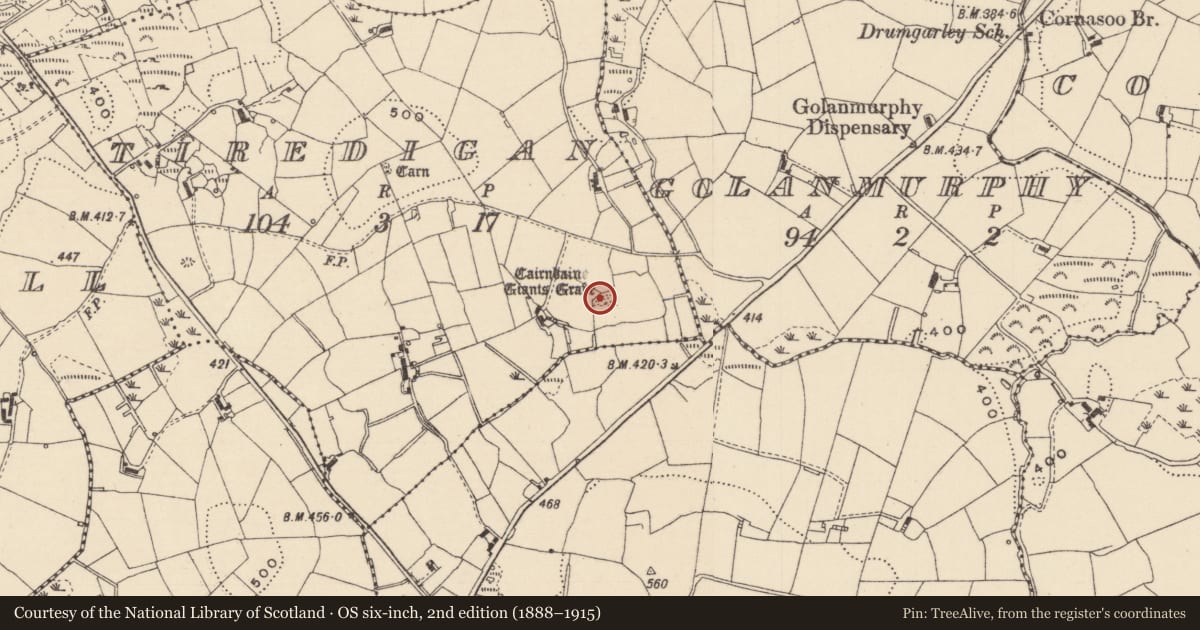
- Cairnbaine Giants Grave
- Coordinates
- 54.19730, -7.07477
- SMR number
- MO012-041----
Slide toward Today to fade the historical sheet and see the modern map underneath.
David Rumsey Map Collection, Stanford LibrariesDavid Rumsey Map Collection, Stanford LibrariesDavid Rumsey Map Collection, Stanford LibrariesDavid Rumsey Map Collection, Stanford Libraries
4 historical maps cover this location, the earliest the 1636 map "Vltoniae Orientalis Pars" (David Rumsey Map Collection, Stanford Libraries).
Historical maps covering this location
- 1636 · Vltoniae Orientalis Pars (David Rumsey Map Collection, Stanford Libraries)
- 1790 · Composite: Ireland. (David Rumsey Map Collection, Stanford Libraries)
- 1869 · Ireland. (David Rumsey Map Collection, Stanford Libraries)
- 1891 · Ireland 16 (David Rumsey Map Collection, Stanford Libraries)
This record in the National Monuments Service's Historic Environment Viewer ↗
The National Monuments Service's description
Located on rock outcrop towards the bottom of the SE-facing slope of the spine of a NW-SE drumlin ridge. It is marked only on the 1907 edition of the OS 6-inch map where it is described in gothic lettering as ‘Cairnbaine Giant’s Grave’. This is probably a dual court-tomb incorporated into a trapezoidal cairn aligned ENE-WSW (L 36m; max. Wth 19m at E). The E tomb has the remains of a three-quarter court (L 6.5m; Wth 5.5m) with two façade stones to the N of the gallery. Two entry jambs surmounted by a lintel give access to a chamber (L 4m; Wth 1.7m). Beyond this, two segmenting jambs indicate a continuation of the gallery. At the opposite end of the cairn is a chamber (L 2.3m; Wth 1.2m) with double jambs open to the W. (de Valera 1960, 123).
The above description is derived from the published 'Archaeological Inventory of County Monaghan' (Dublin: Stationery Office, 1986). In certain instances the entries have been revised and updated in the light of recent research.
This is a National Monument in Guardianship: No. 367
Date of upload: 17 July 2007
References
de Valera, R. 1960 The court cairns of Ireland. Proceedings of the Royal Irish Academy 60C, 9-140.
Nearby in the register
- Cairn - unclassifiedunder 1 mi
- Megalithic tomb - unclassifiedunder 1 mi
- Enclosure - large enclosureunder 1 mi
- Cairn - unclassifiedunder 1 mi
Other entries of the same register within about three miles of this one, by straight line.