Sites and Monuments Record · Ireland
Graveyard
Donagh, County Monaghan, Ireland
The record
- Townland
- Donagh
- County
- Monaghan
- Country
- Ireland
- First-edition OS map
- Donagh
- Latest-edition OS map
- Grave Yard
- Coordinates
- 54.31199, -6.91828
- SMR number
- MO007-007004-
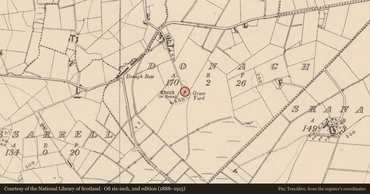
Slide toward Today to fade the historical sheet and see the modern map underneath.
David Rumsey Map Collection, Stanford LibrariesDavid Rumsey Map Collection, Stanford LibrariesDavid Rumsey Map Collection, Stanford LibrariesDavid Rumsey Map Collection, Stanford Libraries
4 historical maps cover this location, the earliest the 1636 map "Vltoniae Orientalis Pars" (David Rumsey Map Collection, Stanford Libraries).
Historical maps covering this location
- 1636 · Vltoniae Orientalis Pars (David Rumsey Map Collection, Stanford Libraries)
- 1790 · Composite: Ireland. (David Rumsey Map Collection, Stanford Libraries)
- 1869 · Ireland. (David Rumsey Map Collection, Stanford Libraries)
- 1891 · Ireland 16 (David Rumsey Map Collection, Stanford Libraries)
This record in the National Monuments Service's Historic Environment Viewer ↗
The National Monuments Service's description
Located on top of a broad hill. The site of the medieval parish church of Donagh (MO007-007001-) is within a sub-triangular graveyard (dims c. 57m E-W; c. 53m N-S) defined by earthen banks and scarps with hedges. The base of the triangle is on the S side and with the SE angle missing. The headstones, dating largely from the late eighteenth century to the mid nineteenth century, have been recorded (McCarney 1957). A fragment of a doorway arch (dims 0.91m x 0.26m x 0.2m) along with a stone corbel (dims 0.66m x 0.25m x 0.28m) with the possible head of a cleric carved relief were acquired by Monaghan County Museum during the 1970s (Walsh 1979, 117). During the 1980s a fragment (dims 0.21m x 0.12m x 0.12m) of a cut stone window jamb decorated with a keel moulding of late 12th early 13th century date was also acquired (Walsh 1983, 170). Part of the head of a ringed cross (MO007-007010-) was also donated to the museum. The graveyard is now owned by Monaghan County Council with parking for about three cars outside.
Within the graveyard is a cup-marked stone (MO007-014009-), the Donagh cross (MO007-014003-), two cross-bases (MO007-014002-; MO007-014005-), two seventeenth century graveslabs (MO007-014007-; (MO007-014008-), and a cross-shaped headstone dated 1666 (MO007-014006-).
Compiled by: Michael Moore
Date of revised upload: 8 November 2016
References
Walsh, A. 1979 Monaghan County Museum Archaeological Acquisitions 1974-75. Clogher Record 10, 110-36.
McCarney, B. 1957 Inscriptions in Donagh Cemetery: Co. Monaghan. Clogher Record 2, 192-203.
Nearby in the register
- Crossunder 1 mi
- Churchunder 1 mi
- Crossunder 1 mi
- Cupmarked stoneunder 1 mi
Other entries of the same register within about three miles of this one, by straight line.