Sites and Monuments Record · Ireland
Excavation - miscellaneous
Piercetown (Dunboyne By.), County Meath, Ireland
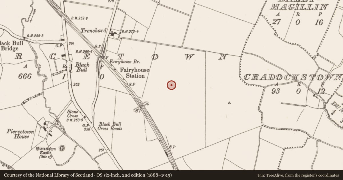
The record
- Townland
- Piercetown (Dunboyne By.)
- County
- Meath
- Country
- Ireland
- First-edition OS map
- Not indicated
- Latest-edition OS map
- Not indicated
- Coordinates
- 53.44914, -6.47349
- SMR number
- ME050-055----
Slide toward Today to fade the historical sheet and see the modern map underneath.
David Rumsey Map Collection, Stanford LibrariesDavid Rumsey Map Collection, Stanford LibrariesDavid Rumsey Map Collection, Stanford LibrariesDavid Rumsey Map Collection, Stanford Libraries
4 historical maps cover this location, the earliest the 1799 map "Ireland." (David Rumsey Map Collection, Stanford Libraries).
Historical maps covering this location
- 1799 · Ireland. (David Rumsey Map Collection, Stanford Libraries)
- 1811 · Ireland. (David Rumsey Map Collection, Stanford Libraries)
- 1830 · V.3:11-15:XV. Britisches Reich. C. Kon: Ireland. a. Prov: Leinster. Counties: 1-12 (David Rumsey Map Collection, Stanford Libraries)
- 1891 · Ireland 16 (David Rumsey Map Collection, Stanford Libraries)
This record in the National Monuments Service's Historic Environment Viewer ↗
The National Monuments Service's description
Systematic archaeological testing (16E0451) by Deirdre Murphy of the development area within Piercetown explored the larger enclosures (excavations.ie 2016:463). This programme also identified a third enclosure and three other potential, but smaller, archaeological areas. Final archaeological monitoring (16E0451) by Deirdre Murphy of the removal of topsoil identified further features throughout the development area, but most of these were either related to the identified monuments or to drainage and almost all were resolved under the original licence (excavations.ie 2106:463). Area 7 between Sites 1 and 2 produced three small pits (dims 0.4-0.9m; D 0.1-0.24m) and three ditches (L 49m; Wth 0.68m; D 0.25m; L 16m plus, Wth 0.8m; D 0.25m; 16m plus; Wth 1.05m; D 0.25m) dispersed over a large area but no artefacts or dating material was recovered. (Murphy 2019a, P 13-14, 20-21, 25)
Compiled by: Michael Moore
Date of upload; 3 November 2021
References
Murphy, Deirdre 2019a Archaeological Monitoring Report, Piercetown, Co. Meath. Licence: 16E0451. Unpublished report, Archaeological Consultancy Services
Nearby in the register
- Enclosure - large enclosureunder 1 mi
- Enclosure - large enclosureunder 1 mi
- Excavation - miscellaneousunder 1 mi
- Ring-ditchunder 1 mi
Other entries of the same register within about three miles of this one, by straight line.