Sites and Monuments Record · Ireland
Graveyard
Greenoge, County Meath, Ireland
The record
- Townland
- Greenoge
- County
- Meath
- Country
- Ireland
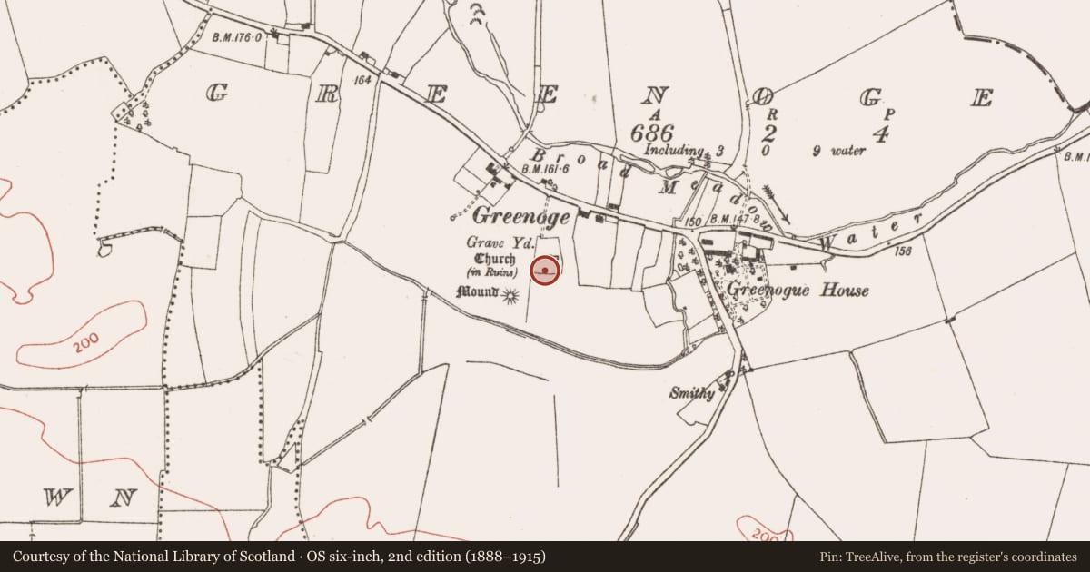
- First-edition OS map
- Grave Yard
- Latest-edition OS map
- Grave Yard
- Coordinates
- 53.48825, -6.34947
- SMR number
- ME045-018002-
Slide toward Today to fade the historical sheet and see the modern map underneath.
David Rumsey Map Collection, Stanford LibrariesDavid Rumsey Map Collection, Stanford LibrariesDavid Rumsey Map Collection, Stanford LibrariesDavid Rumsey Map Collection, Stanford Libraries
4 historical maps cover this location, the earliest the 1790 map "Composite: Ireland." (David Rumsey Map Collection, Stanford Libraries).
Historical maps covering this location
- 1790 · Composite: Ireland. (David Rumsey Map Collection, Stanford Libraries)
- 1799 · Ireland. (David Rumsey Map Collection, Stanford Libraries)
- 1811 · Ireland. (David Rumsey Map Collection, Stanford Libraries)
- 1891 · Ireland 16 (David Rumsey Map Collection, Stanford Libraries)
This record in the National Monuments Service's Historic Environment Viewer ↗
The National Monuments Service's description
Situated on the crest of an E-W ridge. The parish church of Greenoge (ME045-018----) is within a subrectangular graveyard (dims c. 55m N-S; c. 30m E-W at N to c. 45m E-W at S) defined by masonry walls, with headstones dating largely to the 19th and 20th centuries, although there is a headstone with the date 1753 in the nave of the church where the watch-house (ME045-018001-) occupies the NE corner of the nave and blocks half the chancel arch. The rectangular base of a cross (ME045--018003-) (dims 0.85-0.88m x 0.7m; H 0.24-0.27m) with a socket (dims 0.28m x 0.22m; D 0.2m) is on top of a gate-pier at the original entrance of the graveyard at the NW angle (Feeley 2001, 37). A holy well (ME045-062----) is at the roadside c. 90m to the NE. Archaeological monitoring (E004021) by R. Meenan of the repair of a section of the graveyard wall at E in 2009 produced no archaeological material (excavations.ie 2009:647).
Compiled by: Michael Moore
Date of upload: 8 April, 2015
Amended: 10 February 2021
References
Feeley, E. 2001 A survey of archaeological remains OS sheet 45 – Co. Meath. Ríocht na Mídhe, vol. 12, 27-66.
Nearby in the register
- Watchman's hut - burial groundunder 1 mi
- Churchunder 1 mi
- Crossunder 1 mi
- Barrow - mound barrowunder 1 mi
Other entries of the same register within about three miles of this one, by straight line.