Sites and Monuments Record · Ireland
Barrow - mound barrow
Greenoge, County Meath, Ireland
The record
- Townland
- Greenoge
- County
- Meath
- Country
- Ireland
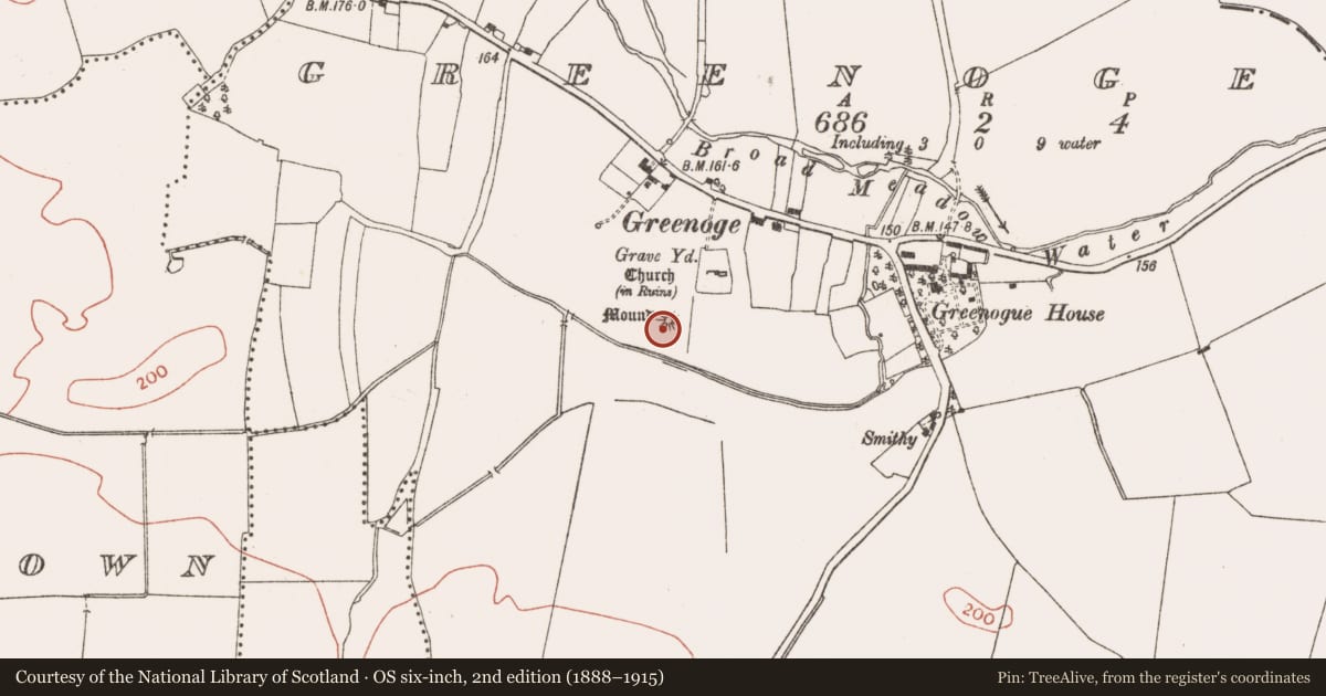
- First-edition OS map
- Mound
- Latest-edition OS map
- Mound
- Coordinates
- 53.48779, -6.35039
- SMR number
- ME045-017----
Slide toward Today to fade the historical sheet and see the modern map underneath.
David Rumsey Map Collection, Stanford LibrariesDavid Rumsey Map Collection, Stanford LibrariesDavid Rumsey Map Collection, Stanford LibrariesDavid Rumsey Map Collection, Stanford Libraries
4 historical maps cover this location, the earliest the 1790 map "Composite: Ireland." (David Rumsey Map Collection, Stanford Libraries).
Historical maps covering this location
- 1790 · Composite: Ireland. (David Rumsey Map Collection, Stanford Libraries)
- 1799 · Ireland. (David Rumsey Map Collection, Stanford Libraries)
- 1811 · Ireland. (David Rumsey Map Collection, Stanford Libraries)
- 1891 · Ireland 16 (David Rumsey Map Collection, Stanford Libraries)
This record in the National Monuments Service's Historic Environment Viewer ↗
The National Monuments Service's description
Located on a broad WNW-ESE ridge with the WNW-ESE Broad Meadow Water c. 250m to the N, while the parish church of Greenoge (ME045-018----) is c. 70m to the NE. This is a grass-covered circular earthen mound (diam. of base 17.5m N-S; 16m WNW-ESE; H 2.1m at N to 3.5m at S) with a slight berm around the base at S. A trench has been dug across the mound E-W which is now a slightly sunken grass-covered feature (Wth 2m). Locally, this is thought to have happened c. 1920 when nothing was found except what is described as a pavement (SMR file). (Feeley 2001, 49-5, No. 40)
The above description is derived from the published 'Archaeological Inventory of County Meath' (Dublin: Stationery Office, 1987). In certain instances the entries have been revised and updated in the light of recent research.
Compiled by: Michael Moore
Date of upload: 10 July 2007
Amended: 17 December 2021
References
SMR file - Sites and monuments record files in the National Monuments Service, Department of Housing, Local Government and Heritage.
Feeley, E. 2001 A survey of archaeological remains OS sheet 45 – Co. Meath. Ríocht na Mídhe, vol. 12, 27-66.
Nearby in the register
- Graveyardunder 1 mi
- Churchunder 1 mi
- Watchman's hut - burial groundunder 1 mi
- Crossunder 1 mi
Other entries of the same register within about three miles of this one, by straight line.