Sites and Monuments Record · Ireland
Church
Rataine, County Meath, Ireland
The record
- Townland
- Rataine
- County
- Meath
- Country
- Ireland
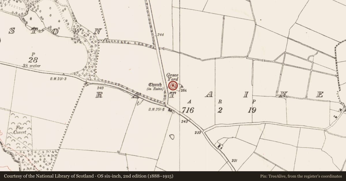
- First-edition OS map
- Church
- Latest-edition OS map
- Church (in Ruins)
- Coordinates
- 53.60573, -6.74854
- SMR number
- ME030-011----
Slide toward Today to fade the historical sheet and see the modern map underneath.
David Rumsey Map Collection, Stanford LibrariesDavid Rumsey Map Collection, Stanford LibrariesDavid Rumsey Map Collection, Stanford LibrariesDavid Rumsey Map Collection, Stanford Libraries
4 historical maps cover this location, the earliest the 1790 map "Composite: Ireland." (David Rumsey Map Collection, Stanford Libraries).
Historical maps covering this location
- 1790 · Composite: Ireland. (David Rumsey Map Collection, Stanford Libraries)
- 1799 · Ireland. (David Rumsey Map Collection, Stanford Libraries)
- 1811 · Ireland. (David Rumsey Map Collection, Stanford Libraries)
- 1891 · Ireland 16 (David Rumsey Map Collection, Stanford Libraries)
This record in the National Monuments Service's Historic Environment Viewer ↗
The National Monuments Service's description
Located on a rise in a fairly level landscape. A church at Rathyn is listed in the ecclesiastical taxation (1302-06) of Pope Nicholas IV (Cal. doc. Ire. 5, 256). Ussher (1622) describes the church and chancel of the parish church of Ratayne as ruined, and this is confirmed by Dopping (1682-5) when the graveyard was not enclosed (Ellision 1972, 12). The grass-covered foundations or low walls of an undivided nave and chancel church (int. dims 21.3m WNW-ESE; 5.65m NNE-SSW) survive together with the W gable (ext. L 7.3m) that has a base-batter. The gable has a double-light ogee-headed window with an external square hood moulding, and there is a double belfry overhead. The graveslab of Richard Bedlow (Bellew) dated 1601 and described by Conwell (1873, 381-2) is no longer present. The site of the deserted settlement (ME030-011001-) is around the rectangular graveyard (dims c. 45m WNW-ESE; c. 30m NNE-SSW) defined by masonry walls.
The above description is derived from the published 'Archaeological Inventory of County Meath' (Dublin: Stationery Office, 1987). In certain instances the entries have been revised and updated in the light of recent research.
Compiled by: Michael Moore
Date of revision: 5 January 2015
References
Erlington, C. R. (ed.) 1847-64 The whole works of the most Reverend James Ussher. 17 vols. Hodges and Smith, Dublin
Conwell, E. A. 1873 A ramble round Trim. Journal of the Royal Society of Antiquaries of Ireland, vol. 12, 361-430.
Ellison, Rev. C. C. 1971-5 Bishop Dopping's Visitation Book 1682-5, Ríocht na Mídhe, 5, 1, 28-39; 5, 2, 3-13; 5, 3, 3-11; 5, 4, 98-103; 6, 1, 3-13.
Cal. doc. Ire. - Calendar of documents relating to Ireland 1171-1307, ed. H.S. Sweetman (5 vols., London, 1875-86).
Nearby in the register
- Graveslabunder 1 mi
- Graveyardunder 1 mi
- Settlement deserted - medievalunder 1 mi
- Graveyardunder 1 mi
Other entries of the same register within about three miles of this one, by straight line.