Sites and Monuments Record · Ireland
Enclosure
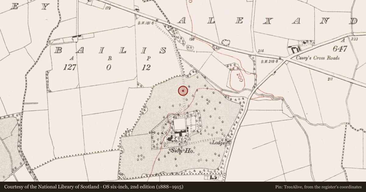
Alexander Reid, County Meath, Ireland
The record
- Townland
- Alexander Reid
- County
- Meath
- Country
- Ireland
- First-edition OS map
- Not indicated
- Latest-edition OS map
- Not indicated
- Coordinates
- 53.64516, -6.64982
- SMR number
- ME025-096001-
Slide toward Today to fade the historical sheet and see the modern map underneath.
David Rumsey Map Collection, Stanford LibrariesDavid Rumsey Map Collection, Stanford LibrariesDavid Rumsey Map Collection, Stanford LibrariesDavid Rumsey Map Collection, Stanford Libraries
4 historical maps cover this location, the earliest the 1790 map "Composite: Ireland." (David Rumsey Map Collection, Stanford Libraries).
Historical maps covering this location
- 1790 · Composite: Ireland. (David Rumsey Map Collection, Stanford Libraries)
- 1799 · Ireland. (David Rumsey Map Collection, Stanford Libraries)
- 1811 · Ireland. (David Rumsey Map Collection, Stanford Libraries)
- 1891 · Ireland 16 (David Rumsey Map Collection, Stanford Libraries)
This record in the National Monuments Service's Historic Environment Viewer ↗
The National Monuments Service's description
The E annexe represents Phase 2 as it appears to be the earliest feature attached to the rath (ME025-096----). It was formed by ditches attaching to the rath fosse at N (Wth 1.94-2.32m; D 0.47-0.55m; L c. 30m) and S that extended E to the wetland area where there was probably a spring. The S ditch runs E (L c. 20m; Wth 1.1-1.7m; D 0.54-0.6m) and then N (L c. 14m; Wth 0.8m; D 0.28-0.38m) to the wetland area, and together the N and S ditches create an irregular area (dims c. 35m N-S; c. 7-30m E-W). An animal skull and the tip of an iron knife were found at the base of the fill of the S ditch at the junction with the rath fosse, and a complete cow skull with the horn sheaths removed was in a discrete sand layer in the basal fill of the N ditch. The E annexe was subdivided into smaller areas by gullies and ditches, some of the plots being devoted to metal-working or cereal-drying kilns. (McGlade 2017, vol. 1, 16-18)
In a third phase a new route for the S arm is created enclosing a larger open area (dims 30m plus E-W), and this ditch ran S of the rath fosse to become the enclosing ditch of the W annexe also when it connects with the original N boundary of the E annexe. A furnace pit (ME025-096008-) was cut into the upper fill of the re-cut E annexe ditch SE of the rath (ibid. 16-22). A fragment of a crucible and two possible anvil stones were recovered in the vicinity. In Phase 4 a new S ditch is provided c. 5m S of the re-routed Phase 3 ditch but while its W end connects with the ditch of the W annexe a return for its E end is not present and it may run into a field system. During Phase 4 the rath became absorbed with the E and W annexes into a large subrectangular enclosure (ME025-096003-) where the principal activity might be represented by the eleven cereal-drying kilns (ME025-096007-) throughout the excavated area. (McGlade 2017, vol. 1, 18-22; 80-1)
Two kilns, a hearth, six pits, two post-holes and ten linear features are within the E annexe. One kiln was cut by the rath fosse at NE and had its flue within the rath. A cow’s skull had been placed at this end of the flue. Of the other kiln only the W firing chamber survived, the rest being destroyed by a drain associated with the modern avenue. Three of the internal linear features are E-W gullies and the others could also serve this purpose. Three intercutting N-S ditches largely respect the N boundary of the E annexe. (McGlade 2017, vol. 1, 33-40)
See the attached images from McGlade (2017, figs P 21, 17) _01 location and late phse: _02 early phase;
Compiled by: Michael Moore
Date of upload: 19 April, 2023
McGlade, S. 2017 Preliminary Excavation Report, Site D, Alexander Reid, Navan. Licence: 16E0449. Archaeology Plan 2 vols
Nearby in the register
- Hut siteunder 1 mi
- Burial groundunder 1 mi
- Metalworking siteunder 1 mi
- Ringfort - rathunder 1 mi
Other entries of the same register within about three miles of this one, by straight line.