Sites and Monuments Record · Ireland
Church
Girley, County Meath, Ireland
The record
- Townland
- Girley
- County
- Meath
- Country
- Ireland
- First-edition OS map
- Old Church
- Latest-edition OS map
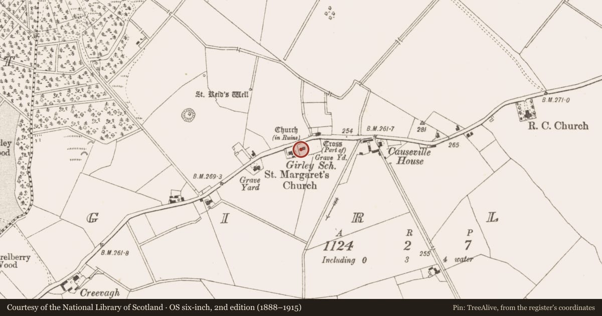
- Church (in Ruins)
- Coordinates
- 53.66605, -6.92435
- SMR number
- ME023-015----
Slide toward Today to fade the historical sheet and see the modern map underneath.
David Rumsey Map Collection, Stanford LibrariesDavid Rumsey Map Collection, Stanford LibrariesDavid Rumsey Map Collection, Stanford LibrariesDavid Rumsey Map Collection, Stanford Libraries
4 historical maps cover this location, the earliest the 1790 map "Composite: Ireland." (David Rumsey Map Collection, Stanford Libraries).
Historical maps covering this location
- 1790 · Composite: Ireland. (David Rumsey Map Collection, Stanford Libraries)
- 1799 · Ireland. (David Rumsey Map Collection, Stanford Libraries)
- 1869 · Ireland. (David Rumsey Map Collection, Stanford Libraries)
- 1891 · Ireland 16 (David Rumsey Map Collection, Stanford Libraries)
This record in the National Monuments Service's Historic Environment Viewer ↗
The National Monuments Service's description
Situated on a rise in an undulating landscape. A church at Girley is listed in the ecclesiastical taxation (1302-06) of Pope Nicholas IV (Cal. doc. Ire. 5, 260). Ussher (1622) describes the church and chancel as ruined (Erlington 1847-64, 1, lxxxix). According to Dopping’s Visitation (1682-5) the church, dedicated to St. Margaret, was in ruins and the graveyard was not enclosed (Ellison 1973, 9). The parish church of Girley is withIn a rectangular graveyard (dims c. 65m ENE-WSW; c. 35-40m NNW-SSE) defined by masonry walls. Only part of the W wall with a wide entrance and buttresses survives. The remains are probably 18th century in date. Some cut stone from windows of a late medieval church (ME023-015003-) are incorporated into the graveyard wall near the entrance. Part of a high cross (ME023-022----) is recorded from the graveyard.
The above description is derived from the published 'Archaeological Inventory of County Meath' (Dublin: Stationery Office, 1987), No. 1408. In this instance the entry has been revised and updated in the light of recent research.
Revised by: Paul Walsh/Michael Moore
Date of upload: 16 December 2014
References
Erlington, C. R. (ed.) 1847-64 The whole works of the most Reverend James Ussher. 17 vols. Hodges and Smith, Dublin
Cal. doc. Ire. - Calendar of documents relating to Ireland 1171-1307, ed. H.S. Sweetman (5 vols., London, 1875-86).
Ellison, Rev. C. C. 1971-5 Bishop Dopping's Visitation Book 1682-5, Ríocht na Mídhe, 5, 1, 28-39; 5, 2, 3-13; 5, 3, 3-11; 5, 4, 98-103; 6, 1, 3-13.
Nearby in the register
- Graveyardunder 1 mi
- Architectural fragmentunder 1 mi
- Cross - High crossunder 1 mi
- Ritual site - holy wellunder 1 mi
Other entries of the same register within about three miles of this one, by straight line.