Sites and Monuments Record · Ireland
Timber circle
Newgrange, County Meath, Ireland
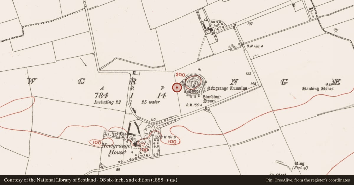
The record
- Townland
- Newgrange
- County
- Meath
- Country
- Ireland
- First-edition OS map
- Not indicated
- Latest-edition OS map
- Not indicated
- Coordinates
- 53.69458, -6.47668
- SMR number
- ME019-046005-
Slide toward Today to fade the historical sheet and see the modern map underneath.
David Rumsey Map Collection, Stanford LibrariesDavid Rumsey Map Collection, Stanford LibrariesDavid Rumsey Map Collection, Stanford LibrariesDavid Rumsey Map Collection, Stanford Libraries
4 historical maps cover this location, the earliest the 1799 map "Ireland." (David Rumsey Map Collection, Stanford Libraries).
Historical maps covering this location
- 1799 · Ireland. (David Rumsey Map Collection, Stanford Libraries)
- 1811 · Ireland. (David Rumsey Map Collection, Stanford Libraries)
- 1830 · V.3:11-15:XV. Britisches Reich. C. Kon: Ireland. a. Prov: Leinster. Counties: 1-12 (David Rumsey Map Collection, Stanford Libraries)
- 1891 · Ireland 16 (David Rumsey Map Collection, Stanford Libraries)
This record in the National Monuments Service's Historic Environment Viewer ↗
The National Monuments Service's description
Located on the E-W ridge of Newgrange and c. 35m W of the kerb of the central passage tomb (ME019-045----). Archaeological excavation (E000261) was conducted during 1984 on the E side of a NNW-SSE field bank in advance of the construction of a temporary roadway. It uncovered the E arc of a timber circle consisting of large inner post-holes (Chord 9m N-S) and an outer ring of usually smaller post-holes (Chord 16m N-S). The larger pits showed signs of burning and had been re-used as post-holes, while the smaller pits contained debris and almost all had post-pits. All the features produce either sherds of Beaker ware, flint debris or cremated remains. A sample (GRN-12828) from one of the larger pits of phase 1 produced a C14 date of 4000 +- 30 bp, which calibrates to 2577-2468 cal. BC while another sample (GRN-12829) from one of the smaller outer pits produced fragments of a Beaker vessel, four flints, a fragment of a stone bowl, and a C14 determination of 3930 +- 35 bp (2562-2299 cal. BC) (Smyth 2009, App. 4, 126). Most of the timber circle (original ext. diam. c. 20-30m) remains unexcavated under a hut or W of the field bank. (Sweetman 1987)
Compiled by: Michael Moore
Date of upload: 8 December 2017
Amended: 27 May 2021
References
Smyth, J. (ed.) 2009 Brú na Bóinne World Heritage Site: Research Framework. The Heritage Council, Kilkenny.
Sweetman, P. D. 1987 Excavation of a Late Neolithic / Early Bronze Age site at Newgrange, Co. Meath. Proceedings of the Royal Irish Academy, 87 C, 6, 283-98.
Nearby in the register
- Megalithic tomb - passage tombunder 1 mi
- Megalithic tomb - passage tombunder 1 mi
- Stone circleunder 1 mi
- Megalithic tomb - passage tombunder 1 mi
Other entries of the same register within about three miles of this one, by straight line.