Sites and Monuments Record · Ireland
Kiln - corn-drying
Knowth, County Meath, Ireland
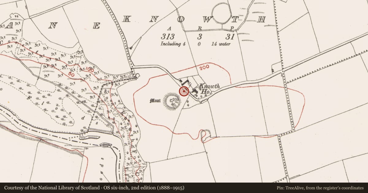
The record
- Townland
- Knowth
- County
- Meath
- Country
- Ireland
- First-edition OS map
- Not indicated
- Latest-edition OS map
- Not indicated
- Coordinates
- 53.70158, -6.49054
- SMR number
- ME019-030069-
Slide toward Today to fade the historical sheet and see the modern map underneath.
David Rumsey Map Collection, Stanford LibrariesDavid Rumsey Map Collection, Stanford LibrariesDavid Rumsey Map Collection, Stanford LibrariesDavid Rumsey Map Collection, Stanford Libraries
4 historical maps cover this location, the earliest the 1790 map "Composite: Ireland." (David Rumsey Map Collection, Stanford Libraries).
Historical maps covering this location
- 1790 · Composite: Ireland. (David Rumsey Map Collection, Stanford Libraries)
- 1799 · Ireland. (David Rumsey Map Collection, Stanford Libraries)
- 1811 · Ireland. (David Rumsey Map Collection, Stanford Libraries)
- 1891 · Ireland 16 (David Rumsey Map Collection, Stanford Libraries)
This record in the National Monuments Service's Historic Environment Viewer ↗
The National Monuments Service's description
Two corn-drying kilns, described as ovens, were built into the mound of Tomb 12. This feature is NW of the chamber and consists of a flue (L 6m; Wth 1m) running E-W but curving to the N, with a fire-pit at either end. The oven was probably on the N side of the flue where there is a gap in the walling but the oven itself was destroyed by a pit (dims 2.6m x 1.8m; D 1m)cut from the surviving top of the mound behind a kerbstone. No primary material was associated with the oven but a redeposited barbed-and-tanged arrowhead was recovered from the pit and a redeposited flint scraper was found on the surviving surface of the tomb mound. The ovens post-date the levelling of the mound which occurred in the first millennium AD. They are not conserved. (Eogan 2012, 181-2)
True location: ITM (669566, 773506)
Compiled by: Michael Moore
Date of upload: 26 November 2013
Amended: 18 September 2020
See the attached illustrations:
_1 Early medieval features, from Knowth 5, Fig. 4:1
_2 plan of kilns, from Kowth 5, Fig. 5:5 (left)
References
Eogan, G. 2012 Excavations at Knowth 5: the archaeology of Knowth in the first and second millennia AD. Dublin. Royal Irish Academy.
Nearby in the register
- Kiln - corn-dryingunder 1 mi
- Kiln - corn-dryingunder 1 mi
- Kiln - corn-dryingunder 1 mi
- Megalithic tomb - passage tombunder 1 mi
Other entries of the same register within about three miles of this one, by straight line.