Sites and Monuments Record · Ireland
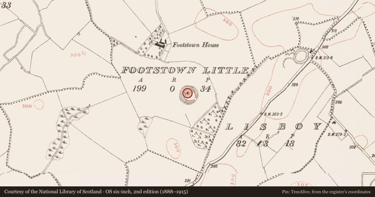
Ringfort - rath
Footstown Little, County Meath, Ireland
The record
- Townland
- Footstown Little
- County
- Meath
- Country
- Ireland
- First-edition OS map
- Fort
- Latest-edition OS map
- Hachured
- Coordinates
- 53.80693, -6.61177
- SMR number
- ME006-048----
Slide toward Today to fade the historical sheet and see the modern map underneath.
David Rumsey Map Collection, Stanford LibrariesDavid Rumsey Map Collection, Stanford LibrariesDavid Rumsey Map Collection, Stanford LibrariesDavid Rumsey Map Collection, Stanford Libraries
4 historical maps cover this location, the earliest the 1636 map "Vltoniae Orientalis Pars" (David Rumsey Map Collection, Stanford Libraries).
Historical maps covering this location
- 1636 · Vltoniae Orientalis Pars (David Rumsey Map Collection, Stanford Libraries)
- 1790 · Composite: Ireland. (David Rumsey Map Collection, Stanford Libraries)
- 1799 · Ireland. (David Rumsey Map Collection, Stanford Libraries)
- 1891 · Ireland 16 (David Rumsey Map Collection, Stanford Libraries)
This record in the National Monuments Service's Historic Environment Viewer ↗
The National Monuments Service's description
Located on a small hillock in an undulating landscape. This is a raised circular and grass-covered area (diam. 50m N-S) defined by an earthen bank (Wth of base 5-7m; int. H 0.3-0.7m; ext. H 2-2.5m) with some bushes which is reduced to a scarp (H 2m) E-S. This is separated by a rounded fosse (Wth of top 10-11m; Wth of base 2.5-3m; ext. D 1-2m) from an outer bank (Wth of base 8-11m; ext. H 2.2-3m) with some trees, and there are slight traces of an outer fosse NW-N (max. ext. diam. 85m N-S). The outer bank has been spread into a platform at W (Wth of base 12.5m E-W; Wth of top 7.5m E-W; int. H 1m; ext. H 2.2m) with slight banks on the inner and outer edges SSW-NNW and at NE. There is an entrance through the outer bank (Wth of base 4m) and a causeway at E but an entrance to the interior is not clear.
The above description is derived from the published 'Archaeological Inventory of County Meath' (Dublin: Stationery Office, 1987). In certain instances the entries have been revised and updated in the light of recent research.
Revised by: Michael Moore
Date of revision: 26 October 2018
Nearby in the register
- Moated siteunder 1 mi
- Ringfort - rathunder 1 mi
- Ringfort - rathunder 1 mi
- Souterrainunder 1 mi
Other entries of the same register within about three miles of this one, by straight line.