Sites and Monuments Record · Ireland
Church
Drumbride, County Meath, Ireland
The record
- Townland
- Drumbride
- County
- Meath
- Country
- Ireland
- First-edition OS map
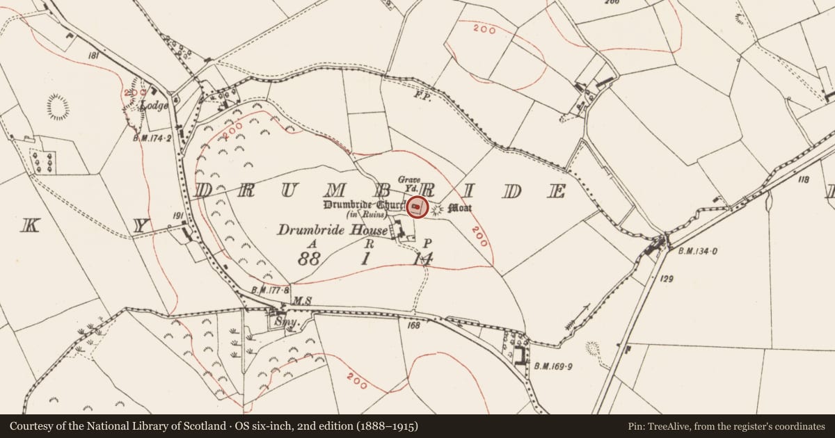
- Drumbride Church in Ruins
- Latest-edition OS map
- Drumbride Church (in Ruins)
- Coordinates
- 53.87915, -6.67429
- SMR number
- ME003-009----
Slide toward Today to fade the historical sheet and see the modern map underneath.
David Rumsey Map Collection, Stanford LibrariesDavid Rumsey Map Collection, Stanford LibrariesDavid Rumsey Map Collection, Stanford LibrariesDavid Rumsey Map Collection, Stanford Libraries
4 historical maps cover this location, the earliest the 1636 map "Vltoniae Orientalis Pars" (David Rumsey Map Collection, Stanford Libraries).
Historical maps covering this location
- 1636 · Vltoniae Orientalis Pars (David Rumsey Map Collection, Stanford Libraries)
- 1790 · Composite: Ireland. (David Rumsey Map Collection, Stanford Libraries)
- 1811 · Ireland. (David Rumsey Map Collection, Stanford Libraries)
- 1891 · Ireland 16 (David Rumsey Map Collection, Stanford Libraries)
This record in the National Monuments Service's Historic Environment Viewer ↗
The National Monuments Service's description
Located towards the top of the E facing slope of a drumlin. The church is marked on the Down Survey (1656-8) barony map of Slane, and in the later middle ages it was probably a chapel of ease in Drumcondra parish, although it is not listed in the visitations of Ussher (1622) (Erlington 1847-64, 1, xci-xcvii) or Dopping (1682-5) (Ellison 1973, 4-7). Cogan (1862-70, 2, 295) regards it as an ancient site dedicated to St. Bridget. Only the E gable and part of the N (L 5.9m) and S (L 8.2m) walls of a rectangular structure (max. dims 8.2m E-W; 6m N-S) survive, largely reduced to the foundations. The E gable has a complete round headed window (Wth 0.1m; H 0.33m) in a round headed embrasure (Wth 0.75m; H 1.53m) and is probably of 12th century date. The church is within a rectangular graveyard (dims c. 40m WNW-ESE; c. 32m NNE-SSW) defined by earthen banks with burials dating from c. 1780 to c. 1960. The motte (ME003-010----) is c. 30m to the E.
The above description is derived from the published 'Archaeological Inventory of County Meath' (Dublin: Stationery Office, 1987). In certain instances the entries have been revised and updated in the light of recent research.
Compiled by: Michael Moore
Date of revision: 10 December, 2014
References
Erlington, C. R. (ed.) 1847-64 The whole works of the most Reverend James Ussher. 17 vols. Hodges and Smith, Dublin
Cogan, Rev. A. 1862-70 Ecclesiastical history of the diocese of Meath: ancient and modern. (3 vols) Dublin: John Fowler, Joseph Dollard
Ellison, Rev. C. C. 1971-5 Bishop Dopping's Visitation Book 1682-5, Ríocht na Mídhe, 5, 1, 28-39; 5, 2, 3-13; 5, 3, 3-11; 5, 4, 98-103; 6, 1, 3-13.
Nearby in the register
- Graveyardunder 1 mi
- Castle - motteunder 1 mi
- Ringfort - rathunder 1 mi
- Standing stoneunder 1 mi
Other entries of the same register within about three miles of this one, by straight line.