Sites and Monuments Record · Ireland
Enclosure
Boleymeelagh,Cregduff (Kilmaine By., Kilcommon Par.), County Mayo, Ireland
The record
- Townland
- Boleymeelagh,Cregduff (Kilmaine By., Kilcommon Par.)
- County
- Mayo
- Country
- Ireland
- First-edition OS map
- Not indicated
- Latest-edition OS map
- Not indicated
- Coordinates
- 53.63186, -9.08150
- SMR number
- MA119-004001-
Slide toward Today to fade the historical sheet and see the modern map underneath.
David Rumsey Map Collection, Stanford LibrariesDavid Rumsey Map Collection, Stanford LibrariesDavid Rumsey Map Collection, Stanford LibrariesDavid Rumsey Map Collection, Stanford Libraries
4 historical maps cover this location, the earliest the 1753 map "Mappa geographica Regni Hiberniae" (David Rumsey Map Collection, Stanford Libraries).
Historical maps covering this location
- 1753 · Mappa geographica Regni Hiberniae (David Rumsey Map Collection, Stanford Libraries)
- 1790 · Composite: Ireland. (David Rumsey Map Collection, Stanford Libraries)
- 1869 · Ireland. (David Rumsey Map Collection, Stanford Libraries)
- 1891 · Ireland 16 (David Rumsey Map Collection, Stanford Libraries)
This record in the National Monuments Service's Historic Environment Viewer ↗
The National Monuments Service's description
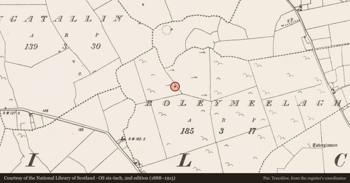
In pasture in gently undulating terrain, on a small hillock at the base of the S-facing slope of a ridge, on top of which a rath (MA119-003----) is located.
Not shown on any edition of the OS 6-inch maps. A raised circular area enclosed by a possible fosse and external bank, and crossed centrally by a field boundary on a NNW−SSE axis, is recorded in an aerial photograph (SMR file: CUCAP AYR 85).
When inspected in 2000, the transecting NNW−SSE field wall was intact, but the rath (on both side of the wall) had been levelled. To W of the field wall, a raised semicircular area (c. 36m N−S; c. 22m E−W; H c. 1.7m), can be still be traced defined on the straight side by the wall; immediately E of the wall, a very slight rise (c. 16m E−W) can be traced at SE but the original E and NE portions of the rath are obliterated by a concrete silage pit (28m NNW−SSE; 13m NE−WSW).
Compiled by: Jane O’Shaughnessy
Date of upload: 30 May 2023
Nearby in the register
- Field systemunder 1 mi
- Enclosureunder 1 mi
- Ringfort - rathunder 1 mi
- Ringfort - rathunder 1 mi
Other entries of the same register within about three miles of this one, by straight line.