Sites and Monuments Record · Ireland
Ringfort - rath
Carrowcastle (Gallen By., Bohola Par.), County Mayo, Ireland
The record
- Townland
- Carrowcastle (Gallen By., Bohola Par.)
- County
- Mayo
- Country
- Ireland
- First-edition OS map
- Indicated
- Latest-edition OS map
- Not indicated
- Coordinates
- 53.91098, -9.07809
- SMR number
- MA071-192----
Slide toward Today to fade the historical sheet and see the modern map underneath.
David Rumsey Map Collection, Stanford LibrariesDavid Rumsey Map Collection, Stanford LibrariesDavid Rumsey Map Collection, Stanford LibrariesDavid Rumsey Map Collection, Stanford Libraries
4 historical maps cover this location, the earliest the 1753 map "Mappa geographica Regni Hiberniae" (David Rumsey Map Collection, Stanford Libraries).
Historical maps covering this location
- 1753 · Mappa geographica Regni Hiberniae (David Rumsey Map Collection, Stanford Libraries)
- 1790 · Composite: Ireland. (David Rumsey Map Collection, Stanford Libraries)
- 1869 · Ireland. (David Rumsey Map Collection, Stanford Libraries)
- 1891 · Ireland 16 (David Rumsey Map Collection, Stanford Libraries)
This record in the National Monuments Service's Historic Environment Viewer ↗
The National Monuments Service's description
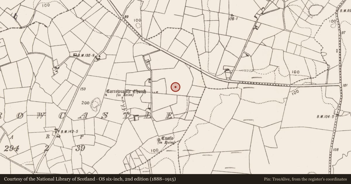
In improved pasture, on a low ridge, overlooking a flat expanse of lowlying, wettish land to SE−S, and overlooked to W by rising ground on which a church (MA071-069----) and an earthwork castle (MA071-070----) are located.
A D-shaped enclosure (max. dim. c. 15m) outlined by a solid line is shown on the 1838 OS 6-inch map; it is not shown on later map editions. It is record in an aerial photograph (SMR file: GSI M 690 -1; Roll 217, pr. 30).
This possible rath is known in local tradition as a 'fort' named 'Rath Eilbhin (Elvin)'.
The remains consist of a raised earthen platform (15m N−S; 15m E−W), an irregular D-shape in plan. It is defined at ENE−SSW by a curving scarp (H 1.8m at E, 1.4m at S), by a straight N−S scarp (H 1.1m) on the W side and by a quarry pit (c. 12m N−S) on the N side. This may represent the surviving SE quadrant of an originally circular enclosure/rath.
Compiled by: Jane O’Shaughnessy
Date of upload: 24 September 2021
Nearby in the register
- Castle - tower houseunder 1 mi
- Churchunder 1 mi
- Castle - motteunder 1 mi
- Ringfort - rathunder 1 mi
Other entries of the same register within about three miles of this one, by straight line.