Sites and Monuments Record · Ireland
Ringfort - rath
Carrowgallda, County Mayo, Ireland
The record
- Townland
- Carrowgallda
- County
- Mayo
- Country
- Ireland
- First-edition OS map
- Indicated
- Latest-edition OS map
- Not indicated
- Coordinates
- 53.92647, -9.07265
- SMR number
- MA071-010----
Slide toward Today to fade the historical sheet and see the modern map underneath.
David Rumsey Map Collection, Stanford LibrariesDavid Rumsey Map Collection, Stanford LibrariesDavid Rumsey Map Collection, Stanford LibrariesDavid Rumsey Map Collection, Stanford Libraries
4 historical maps cover this location, the earliest the 1753 map "Mappa geographica Regni Hiberniae" (David Rumsey Map Collection, Stanford Libraries).
Historical maps covering this location
- 1753 · Mappa geographica Regni Hiberniae (David Rumsey Map Collection, Stanford Libraries)
- 1790 · Composite: Ireland. (David Rumsey Map Collection, Stanford Libraries)
- 1869 · Ireland. (David Rumsey Map Collection, Stanford Libraries)
- 1891 · Ireland 16 (David Rumsey Map Collection, Stanford Libraries)
This record in the National Monuments Service's Historic Environment Viewer ↗
The National Monuments Service's description
In pasture, a thicket of overgrowth, located on a rise. The Gweestion River is 200m to N.
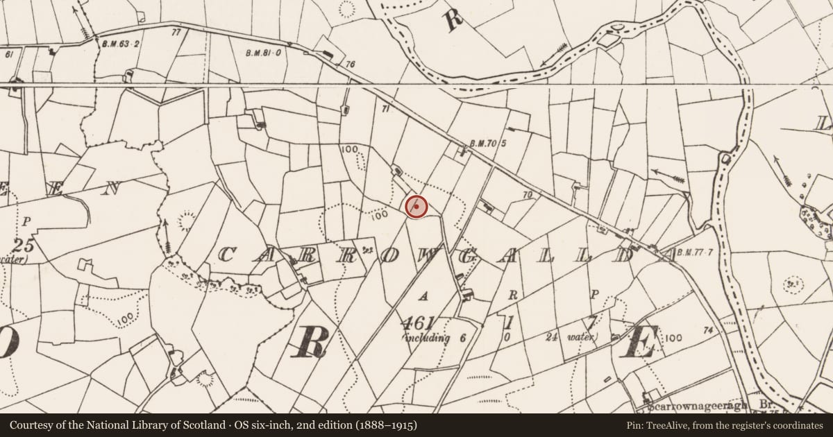
This rath is shown on the 1838 OS 6-inch map as an oval enclosure (c. 60m NW−SE; c. 45m NE−SW), skirted by a laneway at S; it is not shown on the 1931 edition.
The W third of this originally oval rath has been levelled. The E portion of the rath survives as a D-shaped earthen platform (22m NE–SW; 25-30m NW−SE) defined N–SW by a bank/scarp, outside which there is a fosse with remnants of an external bank. A NE–SW property fence defines the straight side of the platform. To W of the fence, the SW arc of the enclosure can still be traced as a degraded scarp but the fosse and external bank are not evident; the NE quadrant has been dug away and levelled out.
The inner bank (Wth 5.4-5.8; int. H 0.2-0.6m; ext. H 1.4m at SE, 2m at SW) on the curving side of the platform survives mainly as a scarp, retaining only a slight internal lip at E–S. At NE it has been incorporated into a field fence on a NW–SE axis. The fosse (Wth 3.2m at SE, 4m at SSW) is evident at N–NE as a very shallow depression and at E–SSW it is broad and flat-bottomed with steep sides where it was incorporated into the laneway (shown on the 1838 OS 6-inch map). The external bank (Wth 4.4m; int. H 1.1-1.5m; ext. H 1.2m) survives only at E–SE. A low area or slump (Wth c. 2m) in the inner bank at E may mark an original entrance. There appears to be a broad depression, perhaps the result of quarrying, to W of centre in the rath interior. The rath is covered in dense blackthorn, hawthorn, elder and sycamore trees.
Compiled by: Jane O’Shaughnessy
Date of upload: 25 June 2021
Nearby in the register
- Ringfort - rathunder 1 mi
- Enclosureunder 1 mi
- Enclosureunder 1 mi
- Ringfort - rathunder 1 mi
Other entries of the same register within about three miles of this one, by straight line.