Sites and Monuments Record · Ireland
Ringfort - rath
Doonbreedia, County Mayo, Ireland
The record
- Townland
- Doonbreedia
- County
- Mayo
- Country
- Ireland
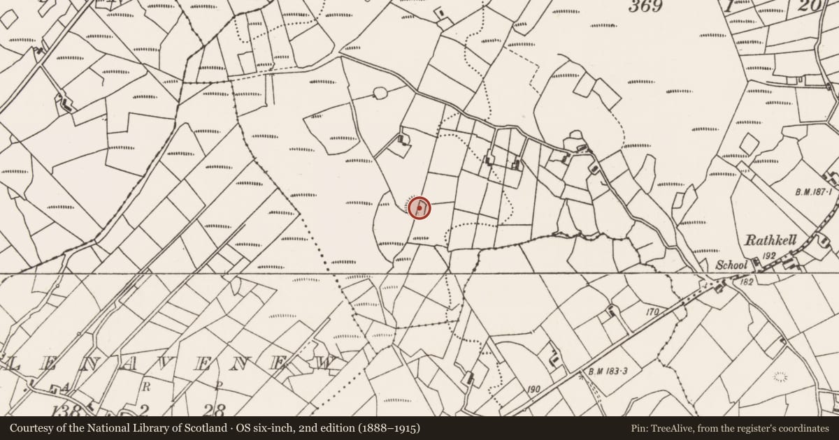
- First-edition OS map
- Indicated
- Latest-edition OS map
- Hachured
- Coordinates
- 54.04501, -9.37366
- SMR number
- MA038-109----
Slide toward Today to fade the historical sheet and see the modern map underneath.
David Rumsey Map Collection, Stanford LibrariesDavid Rumsey Map Collection, Stanford LibrariesDavid Rumsey Map Collection, Stanford LibrariesDavid Rumsey Map Collection, Stanford Libraries
4 historical maps cover this location, the earliest the 1753 map "Mappa geographica Regni Hiberniae" (David Rumsey Map Collection, Stanford Libraries).
Historical maps covering this location
- 1753 · Mappa geographica Regni Hiberniae (David Rumsey Map Collection, Stanford Libraries)
- 1790 · Composite: Ireland. (David Rumsey Map Collection, Stanford Libraries)
- 1869 · Ireland. (David Rumsey Map Collection, Stanford Libraries)
- 1891 · Ireland 16 (David Rumsey Map Collection, Stanford Libraries)
This record in the National Monuments Service's Historic Environment Viewer ↗
The National Monuments Service's description
On a slight rise in average grassland, with an expanse of rough heathery pasture immediately to SW-W.
Slightly raised circular area (diam. 36.5m N-S) defined a scarp/bank. At NE–SW the scarp (W of slope 1.7m; H 1.3m at NE; 1.5m at SE) has a relatively vertical external face, which exhibits remnants of stone facing, suggesting it has been modified to serve as a field fence. At SW-W a short length of bank (W 2.7m; int. H 0.5m; ext. H 1.1m) survives; it has been levelled to a slight undulation at W-NNE.
A property wall, on a NNE-SSW axis, bisects the interior to E of centre. Another field wall, reduced now to a low stony rise, extends E-W through the W half of the interior, intersecting at its E end with the NNE-SSW wall. In the E half of the interior there is a low stony bank (W 2.6m; H 0.4m; L 8m) forming a shallow arc E–NW. The rath perimeter is ringed with overgrowth at N-W. There is another rath (MA038-108----) 200m to NW.
Compiled by: Jane O'Shaughnessy
Date of upload: 9 August 2019
Nearby in the register
- Ringfort - rathunder 1 mi
- Ringfort - rathunder 1 mi
- Children's burial groundunder 1 mi
- Enclosureunder 1 mi
Other entries of the same register within about three miles of this one, by straight line.