Sites and Monuments Record · Ireland
Graveyard
Kilteany, County Mayo, Ireland
The record
- Townland
- Kilteany
- County
- Mayo
- Country
- Ireland
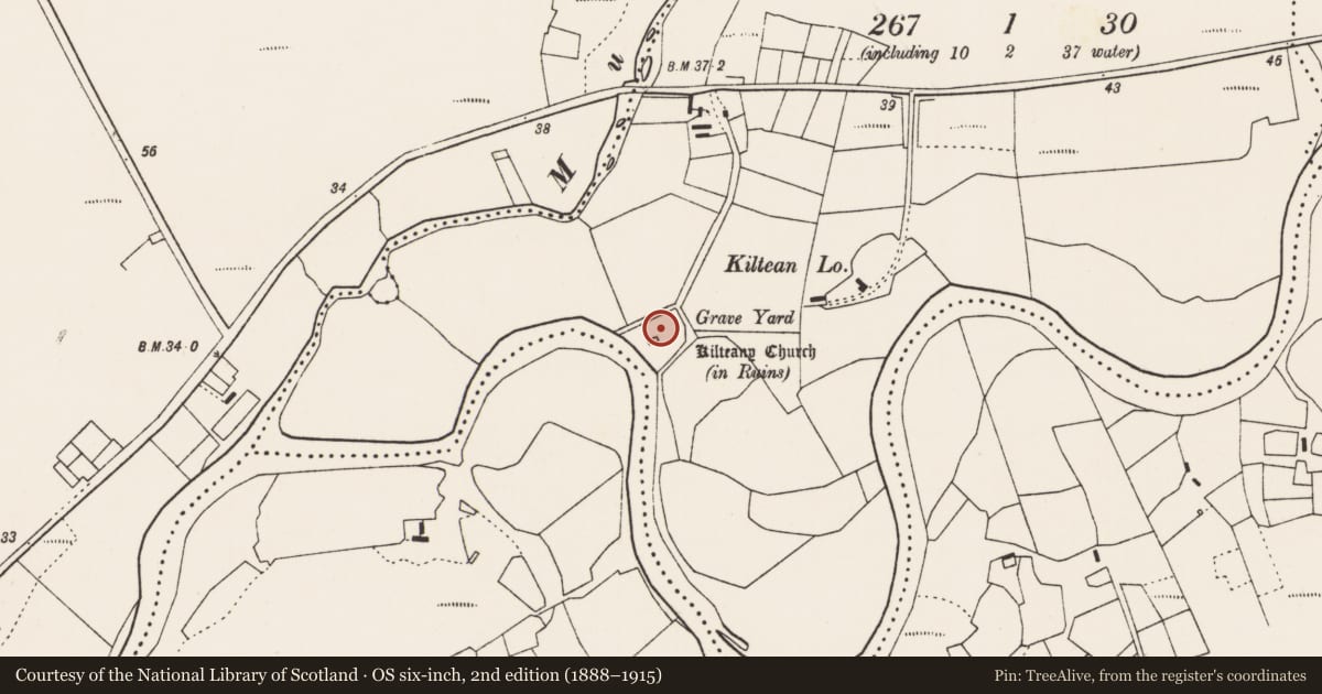
- First-edition OS map
- Grave Yard
- Latest-edition OS map
- Grave yard
- Coordinates
- 54.14290, -9.80301
- SMR number
- MA026-003002-
Slide toward Today to fade the historical sheet and see the modern map underneath.
David Rumsey Map Collection, Stanford LibrariesDavid Rumsey Map Collection, Stanford LibrariesDavid Rumsey Map Collection, Stanford LibrariesDavid Rumsey Map Collection, Stanford Libraries
4 historical maps cover this location, the earliest the 1753 map "Mappa geographica Regni Hiberniae" (David Rumsey Map Collection, Stanford Libraries).
Historical maps covering this location
- 1753 · Mappa geographica Regni Hiberniae (David Rumsey Map Collection, Stanford Libraries)
- 1790 · Composite: Ireland. (David Rumsey Map Collection, Stanford Libraries)
- 1869 · Ireland. (David Rumsey Map Collection, Stanford Libraries)
- 1891 · Ireland 16 (David Rumsey Map Collection, Stanford Libraries)
This record in the National Monuments Service's Historic Environment Viewer ↗
The National Monuments Service's description
Located in lowlying ground on the N bank of the Owenmore River, close to a bend in the river. There are expanses of bog to N and S.
This graveyard is depicted on the 1838 OS 6-inch map as a square area (c. 25m E−W; c. 25m N−S), with the church (MA026-003001-) abutting the W boundary, located c. 50m E of the river bank. By the time of the 1921 edition the graveyard had been expanded to its current roughly trapezoidal extent (c. 60m NNE−SSW; c. 45m WNW−ESE at E end, c. 70m at W end), with the W boundary coinciding with the riverbank. The graveyard is enclosed by a mortared stone wall, with a wrought-iron gate at the NE corner. In the interior ground level rises markedly from the perimeter towards the centre. Several early 20th-century headstones of Celtic type area visible, but many the majority of gravemarkers are engulfed in dense vegetation. There graveyard encloses a medieval parish church (MA026-003001-) and a bullaun stone (MA026-003004-).
Attached image:
MA026-003002-_01.JPG: viewed from N
Compiled by: Jane O'Shaughnessy
Date of upload: 12 December 2017
Nearby in the register
- Religious house - unclassifiedunder 1 mi
- Bullaun stoneunder 1 mi
- Churchunder 1 mi
- Architectural fragment2 mi
Other entries of the same register within about three miles of this one, by straight line.