Sites and Monuments Record · Ireland
Church
Granagh, County Limerick, Ireland
The record
- Townland
- Granagh
- County
- Limerick
- Country
- Ireland
- First-edition OS map
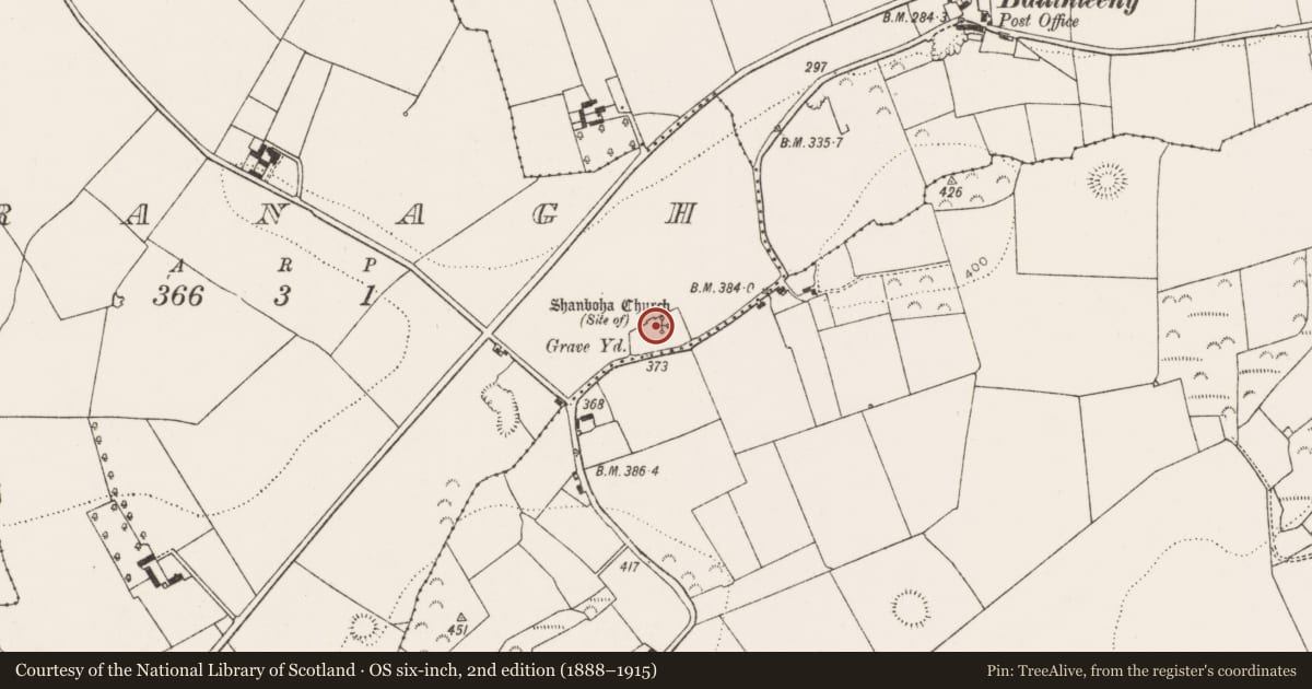
- Shanboha Church (in ruins)
- Latest-edition OS map
- Shanboha Church (Site of) (1923)
- Coordinates
- 52.45028, -8.74573
- SMR number
- LI038-071001-
Slide toward Today to fade the historical sheet and see the modern map underneath.
David Rumsey Map Collection, Stanford LibrariesDavid Rumsey Map Collection, Stanford LibrariesDavid Rumsey Map Collection, Stanford LibrariesDavid Rumsey Map Collection, Stanford Libraries
4 historical maps cover this location, the earliest the 1790 map "Composite: Ireland." (David Rumsey Map Collection, Stanford Libraries).
Historical maps covering this location
- 1790 · Composite: Ireland. (David Rumsey Map Collection, Stanford Libraries)
- 1883 · Ireland 3. (David Rumsey Map Collection, Stanford Libraries)
- 1891 · Ireland 16 (David Rumsey Map Collection, Stanford Libraries)
- 1904 · Sheet 13. (David Rumsey Map Collection, Stanford Libraries)
This record in the National Monuments Service's Historic Environment Viewer ↗
The National Monuments Service's description
Westropp (1904-5, 411) recorded the following details about Shanboha Church; 'Seanboch Capell, 1400; Seanboth, with Kilmocho chapels, the Abbey of Keynsham held them, 1418; Cnockseanmabothy, 1410. St. Maidoc, or Aidan, of Ferns, founded Cloncagh in this deanery; and it is probable that he founded this church, for it bears the name of another of his foundations, Senboithe, or Temple Shanbo, in Scarawalsh. Fabric - fragments of the east and north walls stood in 1840; it is now nearly levelled'.
Church ruins described in 1840 as 'the ruins of an old Church called Shannaboha (Seana Bhoithe) situated in a large grave-yard (LI037-071002-) still in use. This Church is now all destroyed except a small fragment of the east gable and a smaller one of the north side wall, both of which are featureless' (OSL Ballingarry Parish, 25).
Compiled by: Caimin O'Brien
Date of upload: 21 May 2019
References
ASIAP - Archaeological Survey of Ireland Aerial Photographs (c. 1996 - c. 2010).
OSL - Ordnance Survey Letters. Letters written by members of the Ordnance Survey's 'Topographical Department' (T. O'Conor, A. O'Curry, E. Curry, J. O'Donovan and P. O'Keeffe) sent to headquarters from the field (1834-41). MSS in Royal Irish Academy.
Westropp, T.J. 1904-5 A survey of the ancient churches of Co. Limerick. Proceedings of the Royal Irish Academy 25C, 327-479.
Nearby in the register
- Graveyardunder 1 mi
- Ringfort - rathunder 1 mi
- Ringfort - rathunder 1 mi
- Ringfort - rathunder 1 mi
Other entries of the same register within about three miles of this one, by straight line.