Sites and Monuments Record · Ireland
Graveyard
Ballynagallagh, County Limerick, Ireland
The record
- Townland
- Ballynagallagh
- County
- Limerick
- Country
- Ireland
- First-edition OS map
- Burial Ground
- Latest-edition OS map
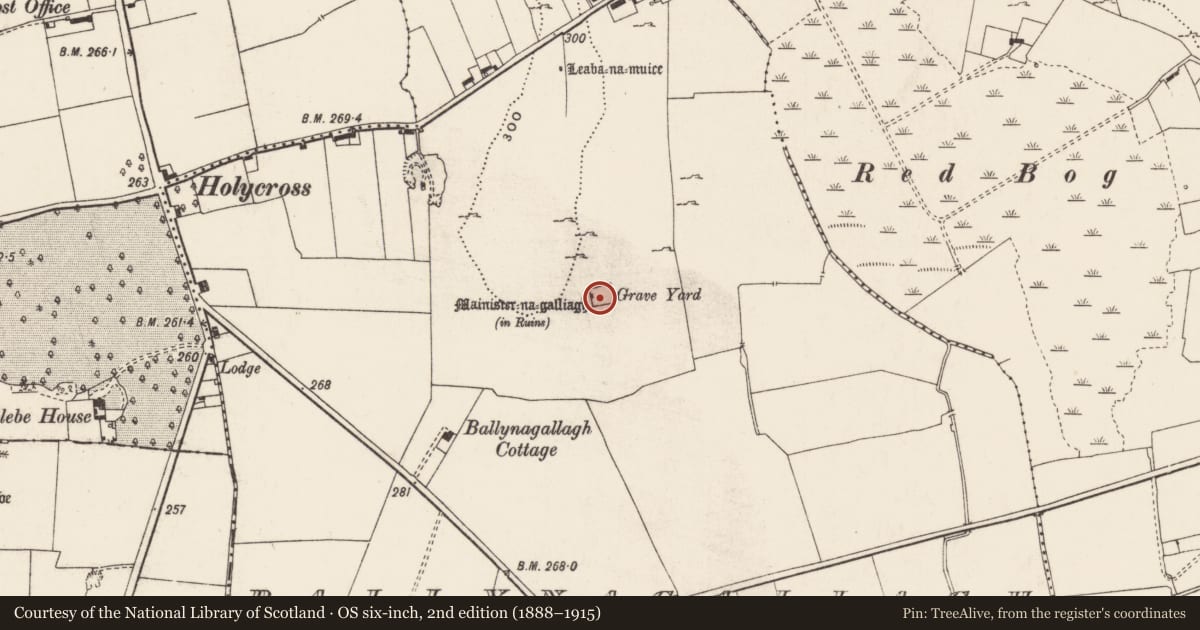
- Grave Yard (1927)
- Coordinates
- 52.50544, -8.53106
- SMR number
- LI032-043003-
Slide toward Today to fade the historical sheet and see the modern map underneath.
David Rumsey Map Collection, Stanford LibrariesDavid Rumsey Map Collection, Stanford LibrariesDavid Rumsey Map Collection, Stanford LibrariesDavid Rumsey Map Collection, Stanford Libraries
4 historical maps cover this location, the earliest the 1790 map "Composite: Ireland." (David Rumsey Map Collection, Stanford Libraries).
Historical maps covering this location
- 1790 · Composite: Ireland. (David Rumsey Map Collection, Stanford Libraries)
- 1869 · Ireland. (David Rumsey Map Collection, Stanford Libraries)
- 1891 · Ireland 16 (David Rumsey Map Collection, Stanford Libraries)
- 1904 · Sheet 13. (David Rumsey Map Collection, Stanford Libraries)
This record in the National Monuments Service's Historic Environment Viewer ↗
The National Monuments Service's description
Situated on N facing slope of rising rocky grassland with good views of the surrounding countryside. The S shoreline of Lough Gur lies 650m to the N. Rectangular shaped graveyard (approx. dims. 27m N-S ; 32m E-W) enclosed by post-1700 wall with entrance stile at W end of N wall close to NW angle. A short section of medieval wall belonging to a 13th century Augustinian nunnery (LI032-043002-) has been incorporated into the W wall of the graveyard. Only two upstanding headstones are visible inside the graveyard which was last used in the 1960s. On the first edition of the OS 6-inch map the graveyard boundary appears to enclose a smaller area with the medieval building (LI032-043002-) standing in NW angle of the burial ground. On the revised 1927 ed. OS 6-inch map the graveyard boundary has been extended to the N forming the outline of the present graveyard. The remains of an earthen bank running parallel to the E wall of the graveyard may represent the remains of an earlier graveyard boundary.
Compiled by: Caimin O'Brien
Date of upload: 5 July 2018
Nearby in the register
- Religious house - Augustinian nunsunder 1 mi
- Earthworkunder 1 mi
- Enclosureunder 1 mi
- Cairn - unclassifiedunder 1 mi
Other entries of the same register within about three miles of this one, by straight line.