Sites and Monuments Record · Ireland
Enclosure
Moanroe (Coonagh By.), County Limerick, Ireland
The record
- Townland
- Moanroe (Coonagh By.)
- County
- Limerick
- Country
- Ireland
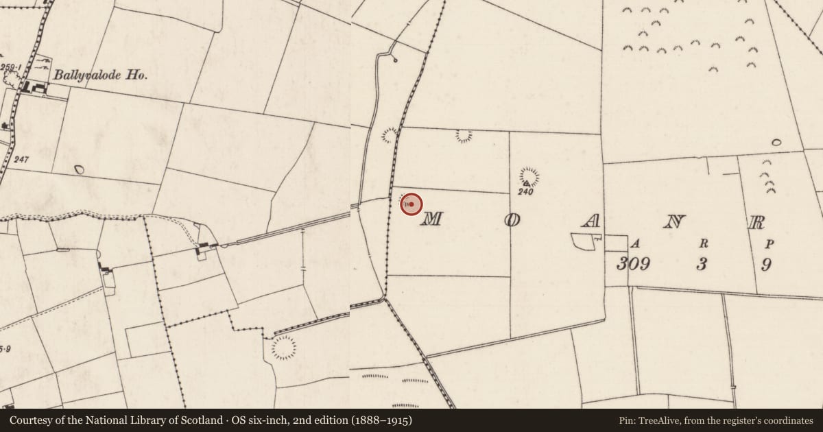
- First-edition OS map
- Hachured
- Latest-edition OS map
- Partially hachured (1928)
- Coordinates
- 52.54581, -8.26488
- SMR number
- LI025-013----
Slide toward Today to fade the historical sheet and see the modern map underneath.
David Rumsey Map Collection, Stanford LibrariesDavid Rumsey Map Collection, Stanford LibrariesDavid Rumsey Map Collection, Stanford LibrariesDavid Rumsey Map Collection, Stanford Libraries
4 historical maps cover this location, the earliest the 1790 map "Composite: Ireland." (David Rumsey Map Collection, Stanford Libraries).
Historical maps covering this location
- 1790 · Composite: Ireland. (David Rumsey Map Collection, Stanford Libraries)
- 1882 · Ireland (southern half). (David Rumsey Map Collection, Stanford Libraries)
- 1891 · Ireland 16 (David Rumsey Map Collection, Stanford Libraries)
- 1904 · Sheet 13. (David Rumsey Map Collection, Stanford Libraries)
This record in the National Monuments Service's Historic Environment Viewer ↗
The National Monuments Service's description
On a gently undulating S-facing slope, in young forestry, with moderate views in all directions, 22m E of a townland boundary with Ballyvalode. Enclosures (LI024-012/014----) lie 105m to NW and 160m to NE, respectively. Depicted on the 1897 ed. OSi 25-inch map as a penannular-shaped earthwork which is open to E. Monument surveyed by the ASI in 1999 and described as a raised circular-shaped area (20m E-W; 18m N-S) enclosed by an earthen bank (Wth 4.1m; int. H 0.25m; ext. H 0.55m) from S-W-NW, reduced to a scarp (Wth 1.1m; H 0.1m) from NW-N-E-S with an external fosse (overall Wth 5.9m; basal Wth 1.2m; D 0.3m). The interior is level, dry and clear of overgrowth. There is no obvious entrance feature. Monument is visible as an unplanted circular-shaped, partially tree-lined earthwork on OSi orthophotos taken 2005-2012, on Digital Globe orthophotos taken 2011-2013 and on Google Earth orthoimage taken 18/11/2018.
See attached Google Earth orthoimage taken 18/11/2018
Compiled by: Alison McQueen and Vera Rahilly
Date of upload: 18 October 2020
Nearby in the register
- Earthworkunder 1 mi
- Earthworkunder 1 mi
- Ringfort - rathunder 1 mi
- Earthworkunder 1 mi
Other entries of the same register within about three miles of this one, by straight line.