Sites and Monuments Record · Ireland
Barrow - ring-barrow
Kilduff, County Limerick, Ireland
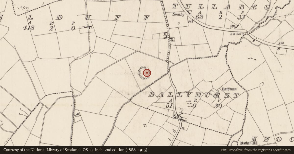
The record
- Townland
- Kilduff
- County
- Limerick
- Country
- Ireland
- First-edition OS map
- Not indicated
- Latest-edition OS map
- Not indicated
- Coordinates
- 52.55507, -8.32989
- SMR number
- LI024-307----
Slide toward Today to fade the historical sheet and see the modern map underneath.
David Rumsey Map Collection, Stanford LibrariesDavid Rumsey Map Collection, Stanford LibrariesDavid Rumsey Map Collection, Stanford LibrariesDavid Rumsey Map Collection, Stanford Libraries
4 historical maps cover this location, the earliest the 1790 map "Composite: Ireland." (David Rumsey Map Collection, Stanford Libraries).
Historical maps covering this location
- 1790 · Composite: Ireland. (David Rumsey Map Collection, Stanford Libraries)
- 1869 · Ireland. (David Rumsey Map Collection, Stanford Libraries)
- 1891 · Ireland 16 (David Rumsey Map Collection, Stanford Libraries)
- 1904 · Sheet 13. (David Rumsey Map Collection, Stanford Libraries)
This record in the National Monuments Service's Historic Environment Viewer ↗
The National Monuments Service's description
In low-lying wet pasture, 45m NW of a townland boundary with Ballyhurst, excellent views of Knockseefin to WNW. Not depicted on OSi historic maps. Situated within large enclosure (LI024-049001-) and one of nine associated ring-barrows of which eight are satellite ring-barrows (LI024-049001-/02-/03-/04-/05-/06-/07-; LI024-288/308----) located outside the large enclosure. Monument surveyed by the ASI in 2008 and described as a low profile circular-shaped area (5.3m NW-SE; 5m NE-SW) defined by a scarp (Wth 0.8-1.15m; H 0.12-0.19m), with fosse (Wth 3.2-3.35m; D 0.14-0.25m) and an outer bank (Wth 3.3-3.95m; int. H 0.14-0.25m; ext. H 0.05-0.15m) which are best preserved from SSW-W-N-E-SSE, levelled from SSE-S-SSW. The interior has a very slight SE-facing slope and is grass covered. Monument is visible as a faint circular-shaped cropmark on OSi orthophoto taken 2005-2012 and on Google Earth orthoimage taken 18/11/2018.
See attached Google Earth orthoimage taken 18/11/2018
Compiled by: Alison McQueen and Vera Rahilly
Date of upload: 16 October 2020
Nearby in the register
- Enclosure - large enclosureunder 1 mi
- Barrow - ring-barrowunder 1 mi
- Barrow - unclassifiedunder 1 mi
- Barrow - unclassifiedunder 1 mi
Other entries of the same register within about three miles of this one, by straight line.