Sites and Monuments Record · Ireland
Moated site
Fedamore, County Limerick, Ireland
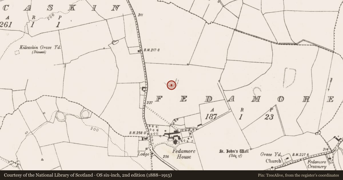
The record
- Townland
- Fedamore
- County
- Limerick
- Country
- Ireland
- First-edition OS map
- Hachured
- Latest-edition OS map
- Hachured (1923)
- Coordinates
- 52.55200, -8.59830
- SMR number
- LI022-095----
Slide toward Today to fade the historical sheet and see the modern map underneath.
David Rumsey Map Collection, Stanford LibrariesDavid Rumsey Map Collection, Stanford LibrariesDavid Rumsey Map Collection, Stanford LibrariesDavid Rumsey Map Collection, Stanford Libraries
4 historical maps cover this location, the earliest the 1790 map "Composite: Ireland." (David Rumsey Map Collection, Stanford Libraries).
Historical maps covering this location
- 1790 · Composite: Ireland. (David Rumsey Map Collection, Stanford Libraries)
- 1869 · Ireland. (David Rumsey Map Collection, Stanford Libraries)
- 1891 · Ireland 16 (David Rumsey Map Collection, Stanford Libraries)
- 1904 · Sheet 13. (David Rumsey Map Collection, Stanford Libraries)
This record in the National Monuments Service's Historic Environment Viewer ↗
The National Monuments Service's description
Enclosure described in 1942-3 as following; 'Only a portion of this structure now remains and it is not clear what the original shape of the monument The remains consist of a bank and fosse. The bank has two arms which meet one another at a point making an angle somewhat less than a right angle. The eastern arm is curved and the other is straight. This suggests that it may have been a D-shaped structure. The east arm is 160' [49m] long and the other 150' [46m]. The fosse is on the outside. It is situate in good low-land. The large field surrounding the monument is intersected by old fences, but it is not possible to say if they are ancient or not' (O'Kelly 1942-3, 227). Partial cropmark of possible square-shaped earthwork visible today on Digital Globe aerial photographs.
Compiled by: Caimin O'Brien
Date of upload: 2 March 2020
References
O'Kelly, M.J. 1942-3 A survey of the antiquities in the barony of Small County, Co. Limerick. North Munster Antiquarian Journal 3, 75-97, 169-84, 222-46.
Nearby in the register
- Ringfort - rathunder 1 mi
- Ringfort - rathunder 1 mi
- Ringfort - rathunder 1 mi
- Ritual site - holy wellunder 1 mi
Other entries of the same register within about three miles of this one, by straight line.