Sites and Monuments Record · Ireland
Stone row
Lackanagoneeny, County Limerick, Ireland
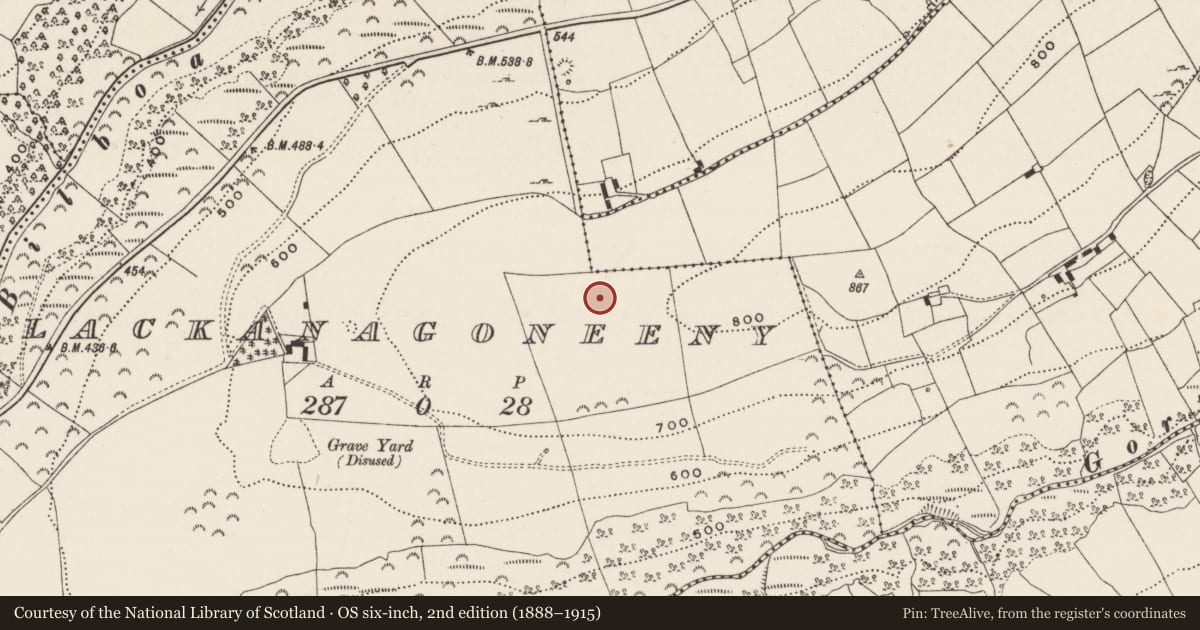
The record
- Townland
- Lackanagoneeny
- County
- Limerick
- Country
- Ireland
- First-edition OS map
- Not indicated
- Latest-edition OS map
- Not indicated
- Coordinates
- 52.63143, -8.23931
- SMR number
- LI016-002001-
Slide toward Today to fade the historical sheet and see the modern map underneath.
David Rumsey Map Collection, Stanford LibrariesDavid Rumsey Map Collection, Stanford LibrariesDavid Rumsey Map Collection, Stanford LibrariesDavid Rumsey Map Collection, Stanford Libraries
4 historical maps cover this location, the earliest the 1790 map "Composite: Ireland." (David Rumsey Map Collection, Stanford Libraries).
Historical maps covering this location
- 1790 · Composite: Ireland. (David Rumsey Map Collection, Stanford Libraries)
- 1869 · Ireland. (David Rumsey Map Collection, Stanford Libraries)
- 1891 · Ireland 16 (David Rumsey Map Collection, Stanford Libraries)
- 1904 · Sheet 13. (David Rumsey Map Collection, Stanford Libraries)
This record in the National Monuments Service's Historic Environment Viewer ↗
The National Monuments Service's description
On a small plateau on the W-facing slope of a hillock, in pasture, overlooking the valley of the Aughvaria River to N and the Gortnageragh River to S. A barrow (LI016-002002-) lies c. 25m to SE. Not depicted on OS historic mapping. Described as three single upright stones set 1m apart and orientated on a N-S axis. The stones are boulder-like in shape and have milky quartz inclusions. The N stone (H 2m) is the tallest, the middle stone (H 1.5m) leans to W and the S stone (H 1.7m) is the second tallest. There are small boulders around the base of the stone row. A single standing stone (LI016-002003-) lies out of alignment, approx. 10m to SE. Its purpose is unclear but it may be an outlier that is associated with the alignment. According to local information, the row is known as ‘The Three Stones’ and may be aligned toward Mother Mountain ‘Mauherslieve’ and the Slieve Felim Mountains to N. Monument is visible on Digital Globe orthophotos taken 2011-13 and on Google Earth orthoimages taken 11/03/2014.
See attached Google Earth orthoimages
Compiled by: Alison McQueen and Vera Rahilly
Date of upload: 10 July 2020
Nearby in the register
- Standing stoneunder 1 mi
- Barrow - unclassifiedunder 1 mi
- Earthworkunder 1 mi
- Burial groundunder 1 mi
Other entries of the same register within about three miles of this one, by straight line.