Sites and Monuments Record · Ireland
Cist
Townparks (Upper Dundalk By.), County Louth, Ireland
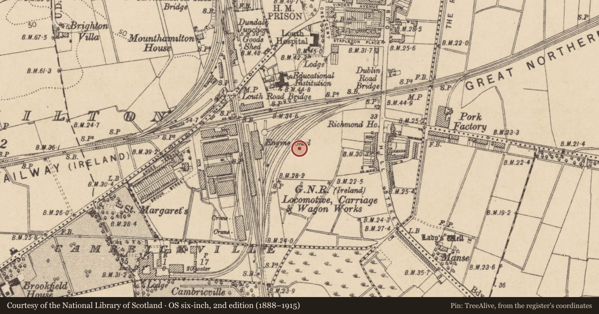
The record
- Townland
- Townparks (Upper Dundalk By.)
- County
- Louth
- Country
- Ireland
- First-edition OS map
- NULL
- Latest-edition OS map
- NULL
- Coordinates
- 53.99585, -6.40969
- SMR number
- LH007-089----
Slide toward Today to fade the historical sheet and see the modern map underneath.
David Rumsey Map Collection, Stanford LibrariesDavid Rumsey Map Collection, Stanford LibrariesDavid Rumsey Map Collection, Stanford LibrariesDavid Rumsey Map Collection, Stanford Libraries
4 historical maps cover this location, the earliest the 1636 map "Vltoniae Orientalis Pars" (David Rumsey Map Collection, Stanford Libraries).
Historical maps covering this location
- 1636 · Vltoniae Orientalis Pars (David Rumsey Map Collection, Stanford Libraries)
- 1799 · Ireland. (David Rumsey Map Collection, Stanford Libraries)
- 1811 · Ireland. (David Rumsey Map Collection, Stanford Libraries)
- 1891 · Ireland 16 (David Rumsey Map Collection, Stanford Libraries)
This record in the National Monuments Service's Historic Environment Viewer ↗
The National Monuments Service's description
The following description is derived from both the published 'Archaeological Inventory of County Louth' (Dublin: Stationery Office, 1986) and the 'Archaeological Survey of County Louth' (Dublin: Stationery Office, 1991). In certain instances the entries have been revised and updated in the light of recent research.
Date of upload/revision: 17 July 2007
Discovered during the sinking of a trial pit by the Great Northern Railway in 1879 prior to the building of workshops. The site consisted of a slight hillock (max. H c. 3m). The first burial was found c. 0.6m below the surface while sinking the trial pit. In 1880 it was decided to remove the hillock completely and between fifty and sixty burials were uncovered. They were all orientated NW-SE, were at an average depth of 0.45m below the topsoil, and were laid in regularly shaped stone-lined cists. The bases of the graves appeared to have had a lining of broken crushed stone. Some of the remains were of children. No finds were recovered from the burials. (CLAJ 1952, 251-2)
Nearby in the register
- Ritual site - holy wellunder 1 mi
- Souterrainunder 1 mi
- Souterrainunder 1 mi
- Excavation - miscellaneousunder 1 mi
Other entries of the same register within about three miles of this one, by straight line.