Sites and Monuments Record · Ireland
Field system
Deerpark (Shrule By.), County Longford, Ireland
The record
- Townland
- Deerpark (Shrule By.)
- County
- Longford
- Country
- Ireland
- First-edition OS map
- Not indicated
- Latest-edition OS map
- Not indicated
- Coordinates
- 53.61457, -7.65799
- SMR number
- LF023-071003-
Slide toward Today to fade the historical sheet and see the modern map underneath.
David Rumsey Map Collection, Stanford LibrariesDavid Rumsey Map Collection, Stanford LibrariesDavid Rumsey Map Collection, Stanford LibrariesDavid Rumsey Map Collection, Stanford Libraries
4 historical maps cover this location, the earliest the 1790 map "Composite: Ireland." (David Rumsey Map Collection, Stanford Libraries).
Historical maps covering this location
- 1790 · Composite: Ireland. (David Rumsey Map Collection, Stanford Libraries)
- 1811 · Ireland. (David Rumsey Map Collection, Stanford Libraries)
- 1869 · Ireland. (David Rumsey Map Collection, Stanford Libraries)
- 1891 · Ireland 16 (David Rumsey Map Collection, Stanford Libraries)
This record in the National Monuments Service's Historic Environment Viewer ↗
The National Monuments Service's description
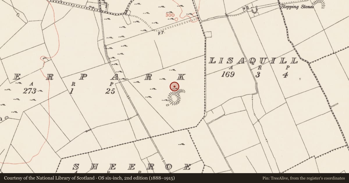
On a low rise in unimproved grassland peppered with outcropping rock; within a walled deerpark (LF023-135----). The remains of this relict field system lie to the N and E of a cashel-like enclosure (LF023-071----) and associated houses (LF023-071001-; LF023-071002-). A series of low grass-covered drystone field walls radiate out for a distance of c. 15m from the enclosure from NW-N-E and run into a curving field wall which mirrors the curve of the enclosure. They form a series of small rectangular fields or paddocks (dims. c. 15m x 10m), some of which contain ridge and furrow cultivation ridges. The field boundaries consist of grass-covered earth and stone banks (H c. 0.5-0.7m; Wth c. 1m), in various states of preservation, which extend c. 150m to the NW and c. 50m to the E of the enclosure. The field system, cashel and houses all appear to be contemporary in date. (CUCAP, AVJ 51)
Compiled by: Caimin O'Brien
Date of upload: 18 June 2012
Nearby in the register
- House - indeterminate dateunder 1 mi
- Ringfort - cashelunder 1 mi
- House - indeterminate dateunder 1 mi
- House - indeterminate dateunder 1 mi
Other entries of the same register within about three miles of this one, by straight line.