Sites and Monuments Record · Ireland
Burial ground
Sriff, County Leitrim, Ireland
The record
- Townland
- Sriff
- County
- Leitrim
- Country
- Ireland
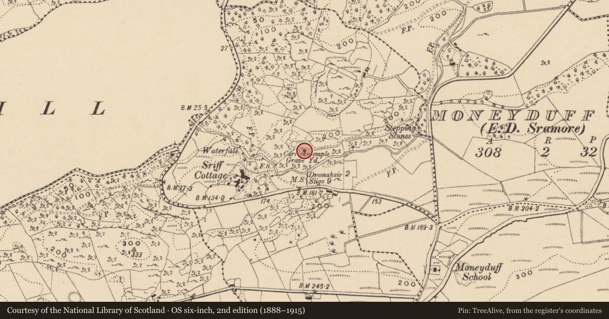
- First-edition OS map
- Burial Ground
- Latest-edition OS map
- Carrickatemple Grave Yd.
- Coordinates
- 54.25600, -8.31051
- SMR number
- LE010-055----
Slide toward Today to fade the historical sheet and see the modern map underneath.
David Rumsey Map Collection, Stanford LibrariesDavid Rumsey Map Collection, Stanford LibrariesDavid Rumsey Map Collection, Stanford LibrariesDavid Rumsey Map Collection, Stanford Libraries
4 historical maps cover this location, the earliest the 1869 map "Ireland." (David Rumsey Map Collection, Stanford Libraries).
Historical maps covering this location
- 1869 · Ireland. (David Rumsey Map Collection, Stanford Libraries)
- 1891 · Ireland 16 (David Rumsey Map Collection, Stanford Libraries)
- 1904 · Sheet 4. (David Rumsey Map Collection, Stanford Libraries)
- 1922 · Ireland - northern section. (David Rumsey Map Collection, Stanford Libraries)
This record in the National Monuments Service's Historic Environment Viewer ↗
The National Monuments Service's description
Located on a NE-SW-facing spur, overlooking a small E-W stream which enters a bay at the E end of Lough Gill c. 270m to the W. This is a subrectangular area (dims 68m E-W; 12-18m N-S) defined by mortared limestone walls (H 1-1.5m). It contains headstones of the 19th and 20th centuries, but has been described as 'ancient' (Lewis 1837, vol. 1, 518). Despite the name – Carrickatemple: the rock of the church – associated with it there are no known ecclesiastical connections, and it is not listed as amongst a 17th century list of churches in north Leitrim (Mooney 1946a).
The above description is derived from 'The Archaeological Inventory of County Leitrim' compiled by Michael J. Moore (Dublin: Stationery Office, 2003). In certain instances the entries have been revised and updated in the light of recent research.
Date of revised upload: 14 April, 2016
References
Lewis, S. 1837 A topographical dictionary of Ireland, 2 vols. London. Lewis and Co.
Mooney, C. 1946a Topographical fragments from the Franciscan Library. Celtica 1, 64-85.
Nearby in the register
- Ringfort - cashelunder 1 mi
- Ringfort - cashelunder 1 mi
- Ringfort - rathunder 1 mi
- Ringfort - cashelunder 1 mi
Other entries of the same register within about three miles of this one, by straight line.