Sites and Monuments Record · Ireland
Sarcophagus
Kyle (Clandonagh By.), County Laois, Ireland
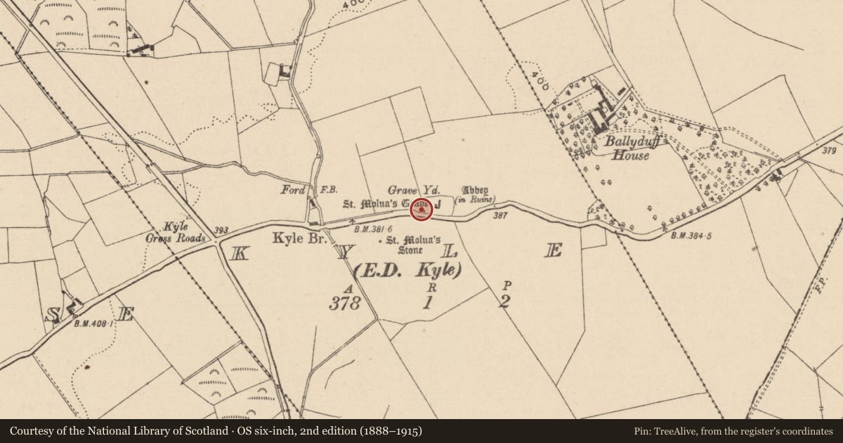
The record
- Townland
- Kyle (Clandonagh By.)
- County
- Laois
- Country
- Ireland
- First-edition OS map
- NULL
- Latest-edition OS map
- NULL
- Coordinates
- 52.96161, -7.65367
- SMR number
- LA015-023004-
Slide toward Today to fade the historical sheet and see the modern map underneath.
David Rumsey Map Collection, Stanford LibrariesDavid Rumsey Map Collection, Stanford LibrariesDavid Rumsey Map Collection, Stanford LibrariesDavid Rumsey Map Collection, Stanford Libraries
4 historical maps cover this location, the earliest the 1790 map "Composite: Ireland." (David Rumsey Map Collection, Stanford Libraries).
Historical maps covering this location
- 1790 · Composite: Ireland. (David Rumsey Map Collection, Stanford Libraries)
- 1811 · Ireland. (David Rumsey Map Collection, Stanford Libraries)
- 1869 · Ireland. (David Rumsey Map Collection, Stanford Libraries)
- 1891 · Ireland 16 (David Rumsey Map Collection, Stanford Libraries)
This record in the National Monuments Service's Historic Environment Viewer ↗
The National Monuments Service's description
St. Molua's Grave located in SW end of graveyard (LA015-023002-) described in the 19th century by T. L. Cooke as 'it is most remarkable, being 12 feet in length by three feet in breadth. A large, rude, and uninscribed stone marks one end; and a nearly similar stone points out the other end. The limits of the sides are defined by rough limestone flags standing on an end. The upper edges of these flags are barely visible above the surface of the ground'. Today, two of these sandstone erect slabs are still visible one placed at a right angle to the other, but the clearly defined elements of the plot observed by the Celtic Cross were one suspects altered by the erection of the commemorative Cross and replaced by modern kerbing in 1920 (Fitzpatrick 1993). This cross was erected by Mrs M. Delaney 1920 to commemorate the burial place of St. Molua.
Shrine of St. Molua now in British Museum. (Crawford J.R.S.A.I. Vol 53, 1923, 76, 80, 87, 161, 162).
The above description is derived from the published 'Archaeological Inventory of County Laois' (Dublin Stationery Office, 1995) compiled by P. David Sweetman, Olive Alcock and Bernie Moran. In certain instances the entries have been revised and updated in the light of recent research.
Date of upload: 17 December 2007
Nearby in the register
- Cross-slabunder 1 mi
- Cross-slabunder 1 mi
- Cross-slabunder 1 mi
- Bullaun stone (present location)under 1 mi
Other entries of the same register within about three miles of this one, by straight line.